UN/LOCODE hub · United Kingdom
GBBPD

Bampton

50.9833°, -3.4833°
1
Transport functions

Transport Functions

Multimodal
UN/LOCODE

Hub Profile

Place type
Populated place
GeoNames
Region
England
GeoNames
Time zone
Europe/London
GeoNames
Elevation
106 m
GeoNames

Location

Location of GBBPD
Natural Earth 10m (public domain) · England · GBBPD · 50.98, -3.48GoogleOSMYandex

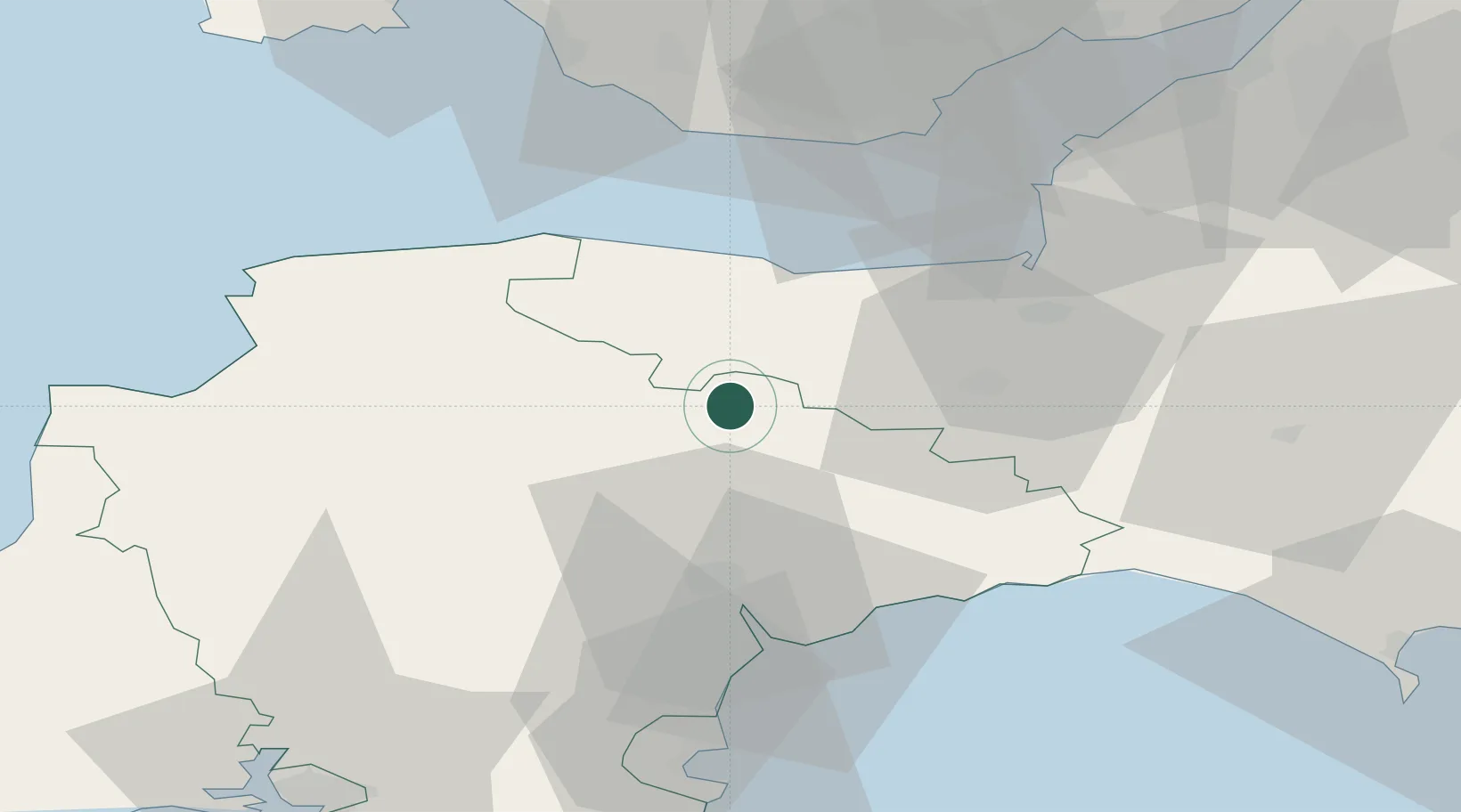
Nearby Logistics Neighbours

Cities
  1. 1Milverton7 km
  2. 2Winsford14 km
  3. 3Luxborough15 km
  4. 4Sampford Arundel15 km
  5. 5Hemyock19 km
Nearest neighbours — logibook spatial index (haversine) over the source coordinates
Ports
  1. 1Watchet Harbor25 km
  2. 2Bridgwater38 km
  3. 3Teignmouth Harbour48 km
  4. 4Barry49 km
  5. 5Bideford50 km
Nearest neighbours — logibook spatial index (haversine) over the source coordinates
Airports
  1. 1Exeter International Airport28 km
  2. 2Cardiff International Airport47 km
  3. 3MOD St Athan47 km
  4. 4Royal Marines Base Chivenor48 km
  5. 5RNAS Yeovilton59 km
Nearest neighbours — logibook spatial index (haversine) over the source coordinates
Trade Zones
  1. 1Exeter & East Devon Enterprise Zone28 km
  2. 2Heart of the South West Enterprise Zone78 km
  3. 3Bristol Temple Quarter Enterprise Zone82 km
  4. 4Oceansgate Plymouth84 km
  5. 5Dorset Innovation Park92 km
Nearest neighbours — logibook spatial index (haversine) over the source coordinates
DatabookThe Record of Consolidated Knowledge
United Kingdom beyond logistics?
Browse databook

All Sources

LocationsUN/LOCODE
UN/LOCODE — free
Portsthe NGA World Port Index
Public domain (US gov)
AirportsOurAirports
Public domain
Trade Zonesthe World Bank SEZ database
CC BY 4.0
Trade ZonesOpen Zone Map
CC BY
← United Kingdom locations