UN/LOCODE hub · United Kingdom
GBBKC

Backaland, Eday

59.1500°, -2.7500°
2
Transport functions

Transport Functions

Port
Road
UN/LOCODE

Hub Profile

Region
ORK
GeoNames

Location

Location of GBBKC
Natural Earth 10m (public domain) · ORK · GBBKC · 59.15, -2.75GoogleOSMYandex

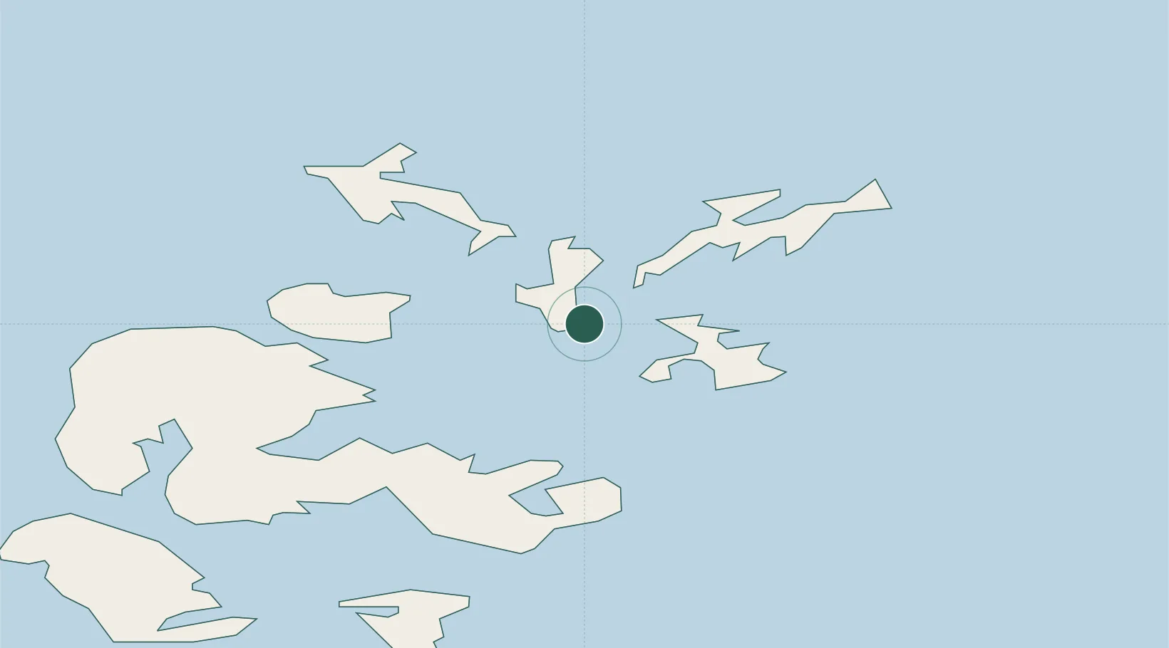
Nearby Logistics Neighbours

Cities
  1. 1Loth, Sanday6 km
  2. 2Whitehall Village, Stronsay8 km
  3. 3Egilsay11 km
  4. 4Orkney12 km
  5. 5Rousay13 km
Nearest neighbours — logibook spatial index (haversine) over the source coordinates
Ports
  1. 1Whitehall9 km
  2. 2Kettletoft13 km
  3. 3Kirkwall22 km
  4. 4Pierowall23 km
  5. 5Scapa Bay26 km
Nearest neighbours — logibook spatial index (haversine) over the source coordinates
Airports
  1. 1Eday Airport5 km
  2. 2Stronsay Airport6 km
  3. 3Sanday Airport15 km
  4. 4Kirkwall Airport23 km
  5. 5Papa Westray Airport24 km
Nearest neighbours — logibook spatial index (haversine) over the source coordinates
Trade Zones
  1. 1Prestwick Airport Free Zone420 km
  2. 2Carlisle Kingmoor Park Enterprise Zone469 km
  3. 3North Eastern Enterprise Zone470 km
  4. 4Tees Valley Enterprise Zone515 km
  5. 5Isle of Man Free Zone and Business Park574 km
Nearest neighbours — logibook spatial index (haversine) over the source coordinates
DatabookThe Record of Consolidated Knowledge
United Kingdom beyond logistics?
Browse databook

All Sources

LocationsUN/LOCODE
UN/LOCODE — free
Portsthe NGA World Port Index
Public domain (US gov)
AirportsOurAirports
Public domain
Trade Zonesthe World Bank SEZ database
CC BY 4.0
Trade ZonesOpen Zone Map
CC BY
← United Kingdom locations