UN/LOCODE hub · France
FRC2H

Chausey

48.8333°, -1.6000°
1
Transport functions

Transport Functions

Port
UN/LOCODE

Hub Profile

Region
50
GeoNames

Location

Location of FRC2H
Natural Earth 10m (public domain) · 50 · FRC2H · 48.83, -1.60GoogleOSMYandex

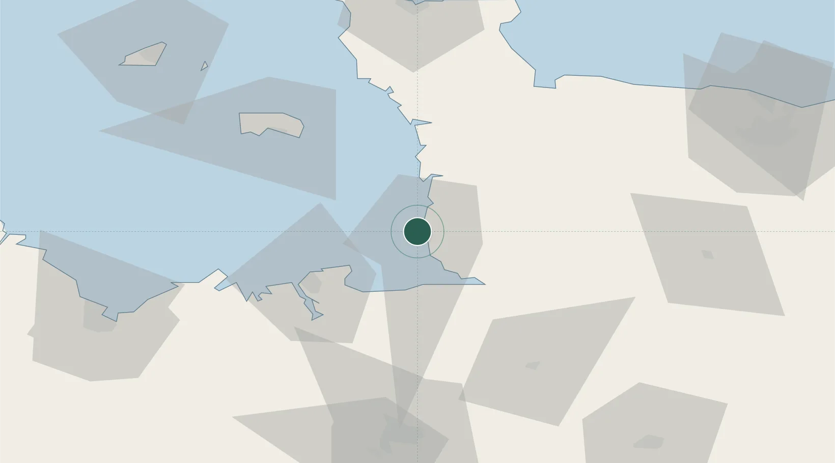
Nearby Logistics Neighbours

Cities
  1. 1Granville1 km
  2. 2Saint-Pair-sur-Mer3 km
  3. 3Saint-Michel-des-Loups9 km
  4. 4Bricqueville-sur-Mer11 km
  5. 5Hauteville-sur-Mer17 km
Nearest neighbours — logibook spatial index (haversine) over the source coordinates
Ports
  1. 1Granville0 km
  2. 2Saint-Malo37 km
  3. 3Saint Helier Harbour54 km
  4. 4Le Legue91 km
  5. 5Rade De Cherbourg91 km
Nearest neighbours — logibook spatial index (haversine) over the source coordinates
Airports
  1. 1Granville Airport6 km
  2. 2Dinard Pleurtuit Saint-Malo airport45 km
  3. 3Jersey Airport60 km
  4. 4Rennes-Saint-Jacques Airport86 km
  5. 5Cherbourg Manche airport91 km
Nearest neighbours — logibook spatial index (haversine) over the source coordinates
Trade Zones
  1. 1ZFU Cherbourg-Octeville90 km
  2. 2ZFU La Guérinière, La Grâce de Dieu95 km
  3. 3ZFU Hérouville-Saint-Clair100 km
  4. 4ZFU Alençon131 km
  5. 5ZFU Le Havre146 km
Nearest neighbours — logibook spatial index (haversine) over the source coordinates
DatabookThe Record of Consolidated Knowledge
France beyond logistics?
Browse databook

All Sources

LocationsUN/LOCODE
UN/LOCODE — free
Portsthe NGA World Port Index
Public domain (US gov)
AirportsOurAirports
Public domain
Trade Zonesthe World Bank SEZ database
CC BY 4.0
Trade ZonesOpen Zone Map
CC BY
← France locations