UN/LOCODE hub · Denmark
DKAAF

Aalbaek

57.5833°, 10.4000°
1
Transport functions

Transport Functions

Multimodal
UN/LOCODE

Hub Profile

Region
81
GeoNames

Location

Location of DKAAF
Natural Earth 10m (public domain) · 81 · DKAAF · 57.58, 10.40GoogleOSMYandex

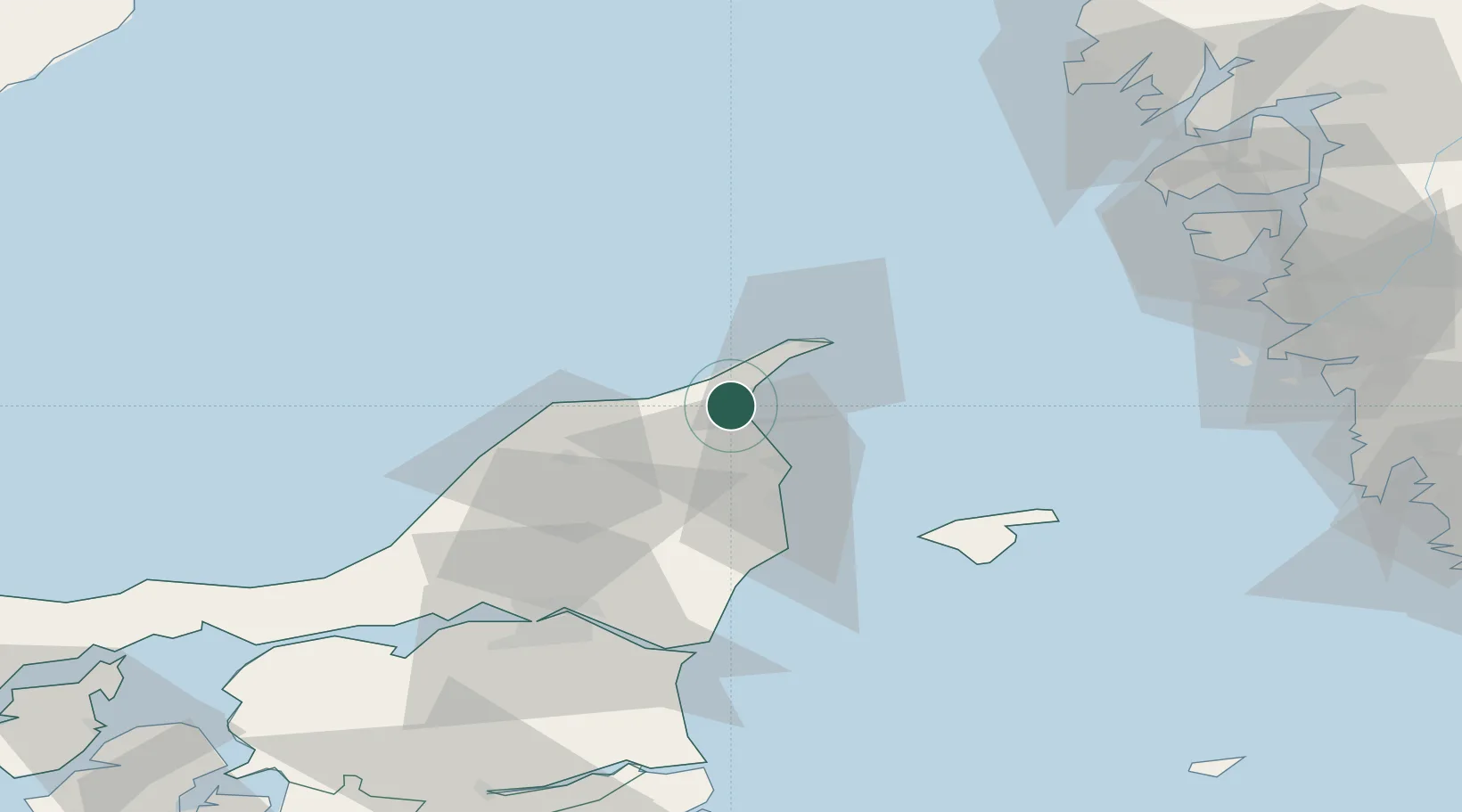
Nearby Logistics Neighbours

Cities
  1. 1Sæby29 km
  2. 2Brønderslev44 km
  3. 3Asaa48 km
  4. 4Langholt57 km
  5. 5Vestbjerg59 km
Nearest neighbours — logibook spatial index (haversine) over the source coordinates
Ports
  1. 1Frederikshavn19 km
  2. 2Skagen Havn19 km
  3. 3Hirtshals26 km
  4. 4Alborg66 km
  5. 5Hals67 km
Nearest neighbours — logibook spatial index (haversine) over the source coordinates
Airports
  1. 1Sindal Airport14 km
  2. 2Læsø Airport50 km
  3. 3Aalborg Airport64 km
  4. 4Säve Airport90 km
  5. 5Göteborg Landvetter Airport112 km
Nearest neighbours — logibook spatial index (haversine) over the source coordinates
Trade Zones
  1. 1Gothenburg Boundless Customs Warehouse85 km
  2. 2Jönköping Free Zone221 km
  3. 3Freeport of Copenhagen- Nordhavn248 km
  4. 4MTS Malmö Transport and Spedition275 km
  5. 5Freeport of Kiel362 km
Nearest neighbours — logibook spatial index (haversine) over the source coordinates
DatabookThe Record of Consolidated Knowledge
Denmark beyond logistics?
Browse databook

All Sources

LocationsUN/LOCODE
UN/LOCODE — free
Portsthe NGA World Port Index
Public domain (US gov)
AirportsOurAirports
Public domain
Trade Zonesthe World Bank SEZ database
CC BY 4.0
Trade ZonesOpen Zone Map
CC BY
← Denmark locations