UN/LOCODE hub · Germany
DEWOI

Wörth bei Erding

48.2333°, 11.9000°
1
Transport functions

Transport Functions

Multimodal
UN/LOCODE

Hub Profile

Region
BY
GeoNames

Location

Location of DEWOI
Natural Earth 10m (public domain) · BY · DEWOI · 48.23, 11.90GoogleOSMYandex

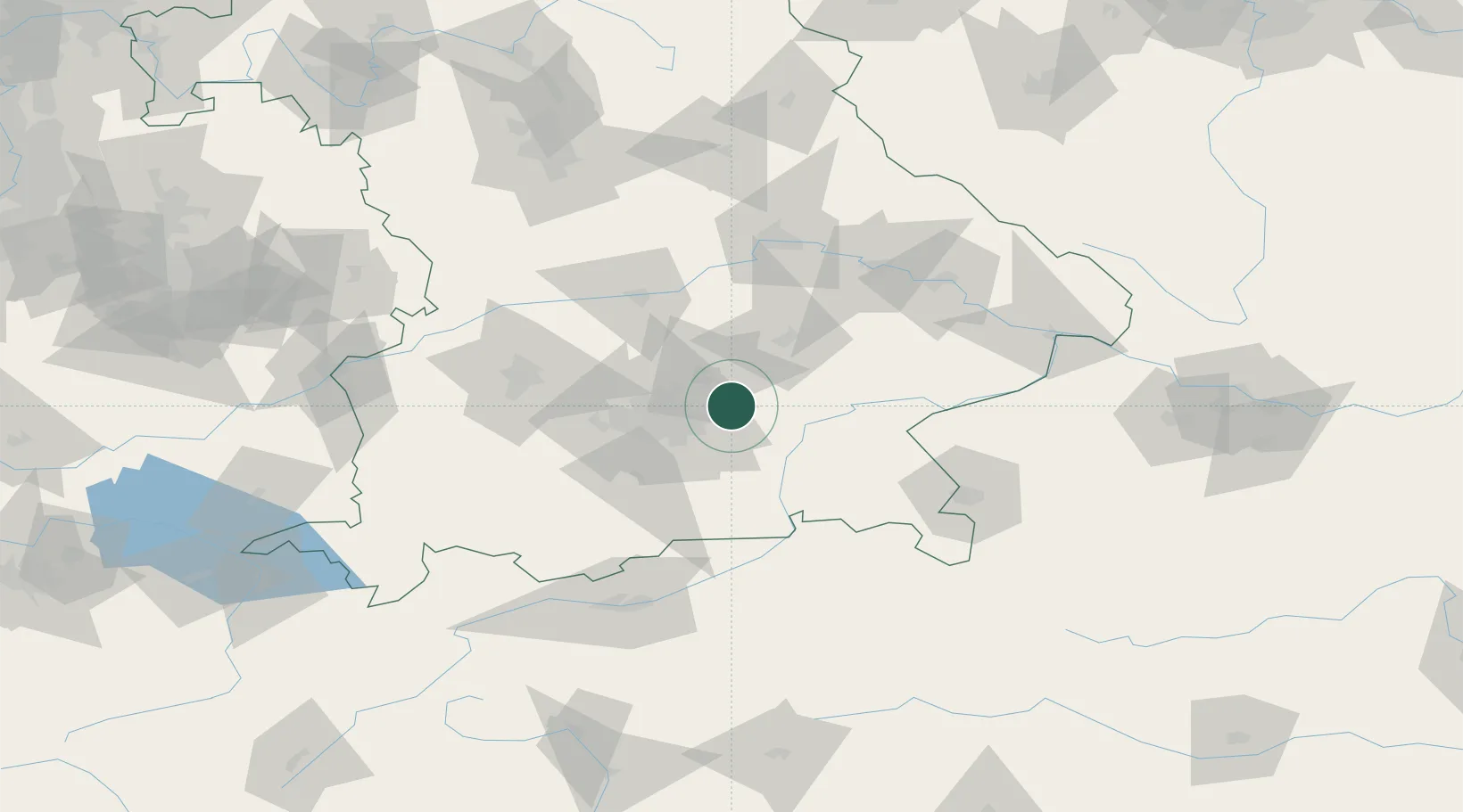
Nearby Logistics Neighbours

Cities
  1. 1Niederneuching4 km
  2. 2Moosinning6 km
  3. 3Oberding10 km
  4. 4Hohenlinden11 km
  5. 5Lengdorf12 km
Nearest neighbours — logibook spatial index (haversine) over the source coordinates
Ports
  1. 1Nogaro291 km
  2. 2Monfalcone300 km
  3. 3Grado301 km
  4. 4Porto Di Lido-Venezia316 km
  5. 5Trieste320 km
Nearest neighbours — logibook spatial index (haversine) over the source coordinates
Airports
  1. 1Munich Airport16 km
  2. 2Landshut Airfield33 km
  3. 3Altstetten Ultralight Field46 km
  4. 4Oberpfaffenhofen Airport49 km
  5. 5Ingolstadt Manching Airport60 km
Nearest neighbours — logibook spatial index (haversine) over the source coordinates
Trade Zones
  1. 1Freeport of Deggendorf101 km
  2. 2Livigno Free Trade Zone233 km
  3. 3Podbořany Industrial Zone247 km
  4. 4Žatec - Triangle Strategic Industrial Zone268 km
  5. 5Most - Joseph Industrial Zone280 km
Nearest neighbours — logibook spatial index (haversine) over the source coordinates
DatabookThe Record of Consolidated Knowledge
Germany beyond logistics?
Browse databook

All Sources

LocationsUN/LOCODE
UN/LOCODE — free
Portsthe NGA World Port Index
Public domain (US gov)
AirportsOurAirports
Public domain
Trade Zonesthe World Bank SEZ database
CC BY 4.0
Trade ZonesOpen Zone Map
CC BY
← Germany locations