UN/LOCODE hub · China
CNSON

Songxia Pt

25.6833°, 119.5833°
1
Transport functions

Transport Functions

Port
UN/LOCODE

Hub Profile

Region
FJ
GeoNames

Location

Location of CNSON
Natural Earth 10m (public domain) · FJ · CNSON · 25.68, 119.58GoogleOSMYandex

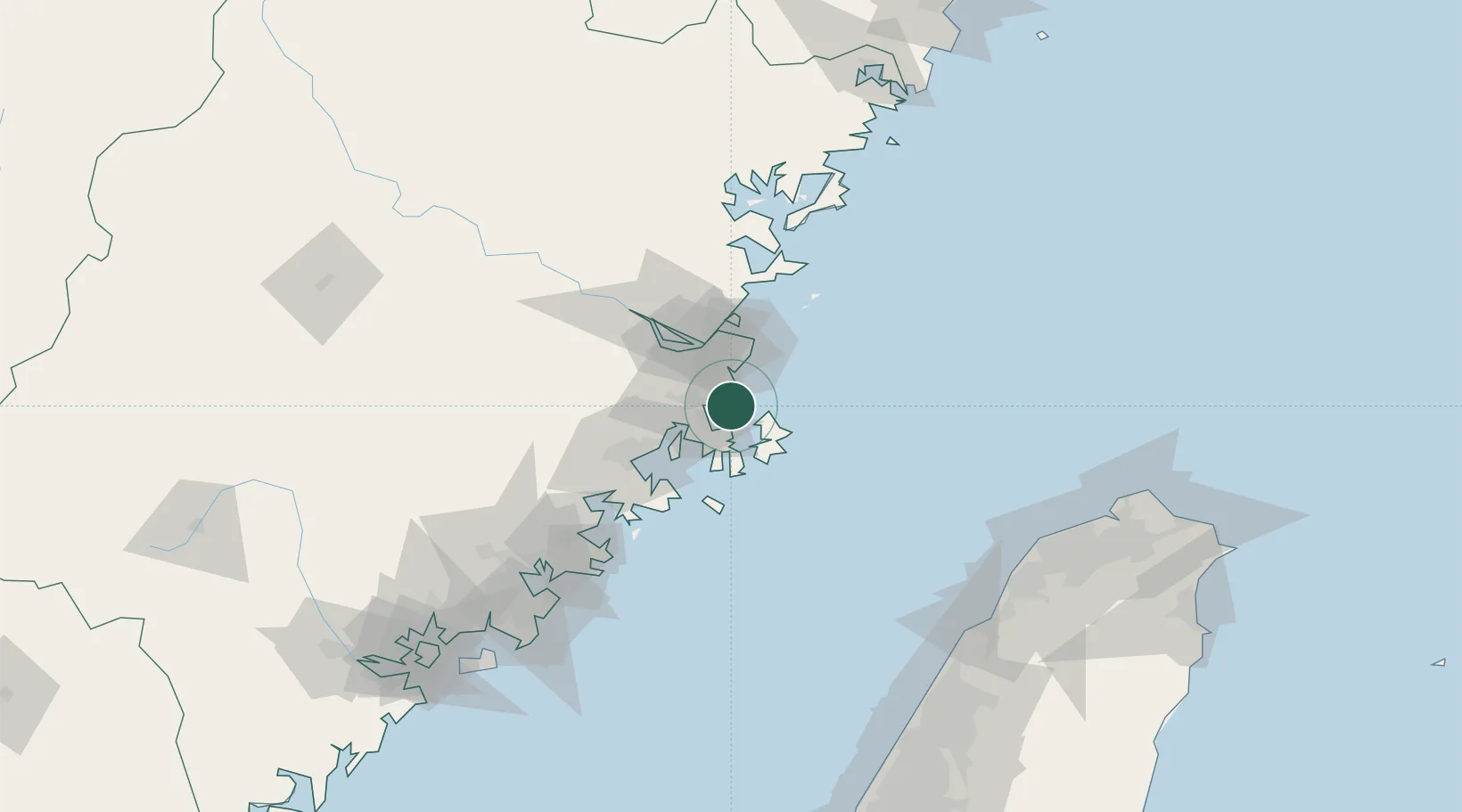
Nearby Logistics Neighbours

Cities
  1. 1Xialong20 km
  2. 2Pingtan24 km
  3. 3Jinjing29 km
  4. 4Qingpu30 km
  5. 5Fuzhou30 km
Nearest neighbours — logibook spatial index (haversine) over the source coordinates
Ports
  1. 1Fuzhou53 km
  2. 2Xiuyu78 km
  3. 3Quanzhou133 km
  4. 4Tai-Chung Kang179 km
  5. 5Zhangzhou182 km
Nearest neighbours — logibook spatial index (haversine) over the source coordinates
Airports
  1. 1Longtian Air Base17 km
  2. 2Fuzhou Changle International Airport29 km
  3. 3Fuzhou Air Base45 km
  4. 4Matsu Nangan Airport65 km
  5. 5Fuzhou Zhuqi Heliport68 km
Nearest neighbours — logibook spatial index (haversine) over the source coordinates
Trade Zones
  1. 1Qingkou Automobile Industrial Park31 km
  2. 2Fujian Changle Economic Development Zone33 km
  3. 3Fuqing Export Processing Zone38 km
  4. 4Jinshan Industrial Park50 km
  5. 5Licheng Economic Development Zone57 km
Nearest neighbours — logibook spatial index (haversine) over the source coordinates
DatabookThe Record of Consolidated Knowledge
China beyond logistics?
Browse databook

All Sources

LocationsUN/LOCODE
UN/LOCODE — free
Portsthe NGA World Port Index
Public domain (US gov)
AirportsOurAirports
Public domain
Trade Zonesthe World Bank SEZ database
CC BY 4.0
Trade ZonesOpen Zone Map
CC BY
← China locations