Seaport · China

ZhangzhouCNZZU

24.6833°, 118.1500°
11.0 m
Channel depth
22.0
Port liner connectivity
Zhangzhou is also a UN/LOCODE logistics hub →

Channel & Berth Profile

SEA LEVEL (CD)CHANNEL BEDCargo pier · 6.4 mChannel · 11.0 mAnchorage · 12.5 m
NGA World Port Index

Pilotage, Tugs & Services

Pilotage compulsoryYES
Pilotage availableYES
Tug assistanceYES
Potable waterYES
NGA World Port Index

Facilities & Capabilities

Container
Ro-Ro
Liquid bulk
Dry bulk
Oil terminal
Break bulk
Dry dock
Repairs
BunkeringYES
Rail linkYES
Dangerous cargo
ISPS security
NGA World Port Index

Harbour Specifications

Harbour size
Small
NGA World Port Index
Harbour type
Coastal (Natural)
NGA World Port Index
Shelter
Fair
NGA World Port Index
Water body
Taiwan Strait; North Pacific Ocean
NGA World Port Index
Tidal range
4 m
NGA World Port Index
Pilotage
Yes
NGA World Port Index

Liner Connectivity

22
PLSCI

Port Liner Shipping Connectivity Index for Zhangzhou, as published by UNCTAD for the latest available quarter. Higher values indicate stronger scheduled liner-shipping integration.

Shown relative to the highest per-port PLSCI in the dataset (1,657.9).

UNCTAD · Port Liner Shipping Connectivity Index

Location

Location of CNZZU
Natural Earth 10m (public domain) · Fujian · CNZZU · 24.68, 118.15GoogleOSMYandex

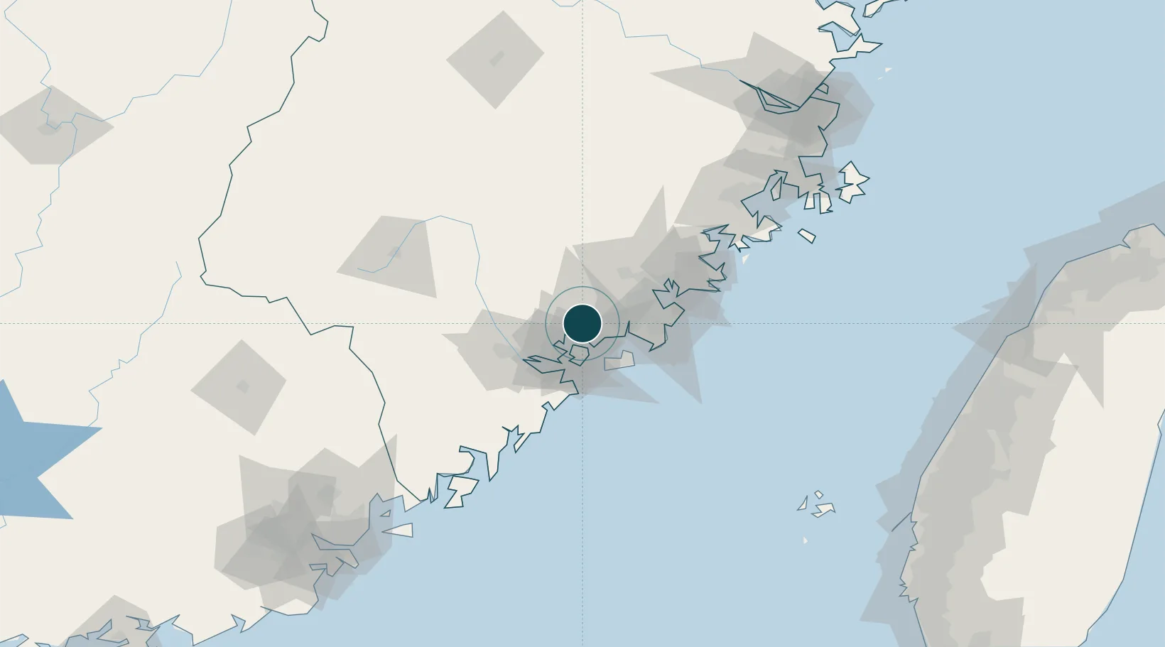
Nearby Logistics Neighbours

Ports
  1. 1Xiamen27 km
  2. 2Quanzhou51 km
  3. 3Xiuyu104 km
  4. 4Dongshan122 km
  5. 5Chaozhou161 km
Nearest neighbours — logibook spatial index (haversine) over the source coordinates
Cities
  1. 1Tongan, Xiamen4 km
  2. 2Xiang'an, Xiamen12 km
  3. 3Jimei,Xiamen12 km
  4. 4Xiamen23 km
  5. 5Dadeng I.24 km
Nearest neighbours — logibook spatial index (haversine) over the source coordinates
Airports
  1. 1Xiamen Gaoqi International Airport16 km
  2. 2Kinmen Airport35 km
  3. 3Quanzhou Jinjiang International Airport46 km
  4. 4Huian Air Base77 km
  5. 5Longtian Air Base165 km
Nearest neighbours — logibook spatial index (haversine) over the source coordinates
Trade Zones
  1. 1Tongan Industrial Park1 km
  2. 2Xiangan Industrial Park11 km
  3. 3Xiamen Export Processing Zone27 km
  4. 4Changtai Economic Development Zone36 km
  5. 5Longhai Economic Development Zone41 km
Nearest neighbours — logibook spatial index (haversine) over the source coordinates
DatabookThe Record of Consolidated Knowledge
China beyond logistics?
Browse databook

All Sources

Portsthe NGA World Port Index
Public domain (US gov)
Logistics performanceUNCTAD
CC BY 3.0 IGO
AirportsOurAirports
Public domain
LocationsUN/LOCODE
UN/LOCODE — free
Trade Zonesthe World Bank SEZ database
CC BY 4.0
Trade ZonesOpen Zone Map
CC BY
← China ports