UN/LOCODE hub · Cameroon
CMEBT

Ebomé Terminal

2.8000°, 9.8167°
2
Transport functions

Transport Functions

Rail
Road
Ebomé Terminal is also a profiled seaport →
UN/LOCODE

Location

Location of CMEBT
Natural Earth 10m (public domain) · Sud · CMEBT · 2.80, 9.82GoogleOSMYandex

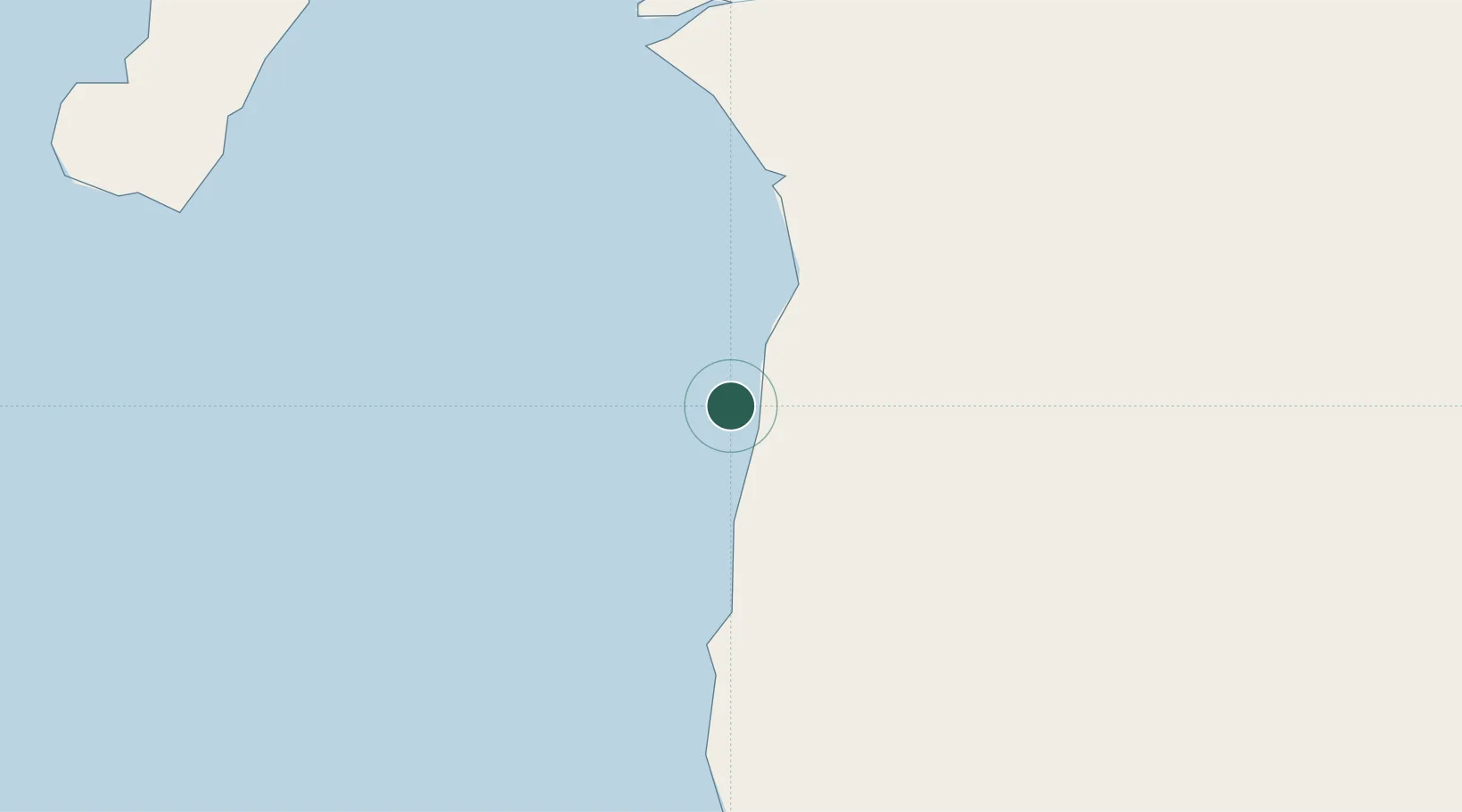
Nearby Logistics Neighbours

Cities
  1. 1Kribi10 km
  2. 2Mayumba56 km
  3. 3Bata109 km
  4. 4Edéa113 km
  5. 5Douala138 km
Nearest neighbours — logibook spatial index (haversine) over the source coordinates
Ports
  1. 1Kome Kribi 1 Marine Terminal13 km
  2. 2Bata104 km
  3. 3Douala140 km
  4. 4Limboh Terminal151 km
  5. 5Malabo156 km
Nearest neighbours — logibook spatial index (haversine) over the source coordinates
Airports
  1. 1Bata International Airport100 km
  2. 2Douala International Airport135 km
  3. 3Tiko Airport152 km
  4. 4Malabo International Airport163 km
  5. 5President Obiang Nguema International Airport183 km
Nearest neighbours — logibook spatial index (haversine) over the source coordinates
Trade Zones
  1. 1Port of Kribi Economic Zone19 km
  2. 2Puerto de Bata Free Port109 km
  3. 3Bassa-Douala Industrial Zone137 km
  4. 4Bonaberi-Douala Industrial Zone142 km
  5. 5Luba Freeport157 km
Nearest neighbours — logibook spatial index (haversine) over the source coordinates
DatabookThe Record of Consolidated Knowledge
Cameroon beyond logistics?
Browse databook

All Sources

LocationsUN/LOCODE
UN/LOCODE — free
Portsthe NGA World Port Index
Public domain (US gov)
AirportsOurAirports
Public domain
Trade Zonesthe World Bank SEZ database
CC BY 4.0
Trade ZonesOpen Zone Map
CC BY
← Cameroon locations