Medium airport · Argentina

(Duplicate)Aeropuerto PergaminoAR-0768

-33.8960°, -60.5748°

Runway & Layout

(Duplicate)Aeropuerto Pergamino runway & taxiway layout
Runway & taxiway layout — OpenStreetMap (ODbL) / OurAirports

Airport Specifications

Airport class
Medium airport
OurAirports
Scheduled service
No
OurAirports

Location

Location of AR-0768
Natural Earth 10m (public domain) · Buenos Aires · AR-0768 · -33.90, -60.57GoogleOSMYandex

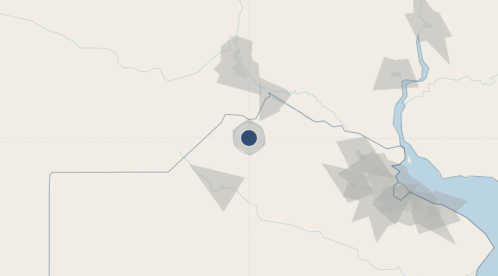
Nearby Logistics Neighbours

Airports
  1. 1Rosario Islas Malvinas International Airport112 km
  2. 2San Fernando Airport193 km
  3. 3El Palomar Airport197 km
  4. 4Gualeguaychu Airport207 km
  5. 5Aeroparque Jorge Newbery212 km
Nearest neighbours — logibook spatial index (haversine) over the source coordinates
Cities
  1. 1Pergamino2 km
  2. 2Alvear26 km
  3. 3Arrecifes47 km
  4. 4Colón50 km
  5. 5Campo Salto53 km
Nearest neighbours — logibook spatial index (haversine) over the source coordinates
Ports
  1. 1Ramallo69 km
  2. 2San Nicolas70 km
  3. 3Villa Constitucion77 km
  4. 4San Pedro78 km
  5. 5Rosario105 km
Nearest neighbours — logibook spatial index (haversine) over the source coordinates
Trade Zones
  1. 1Nueva Palmira Free Zone199 km
  2. 2Zona Sur Buenos Aires208 km
  3. 3Zona Franca UPM232 km
  4. 4UPM Fray Bentos Free Zone232 km
  5. 5Montes de Plata Free Zone235 km
Nearest neighbours — logibook spatial index (haversine) over the source coordinates
DatabookThe Record of Consolidated Knowledge
Argentina beyond logistics?
Browse databook

All Sources

AirportsOurAirports
Public domain
Portsthe NGA World Port Index
Public domain (US gov)
LocationsUN/LOCODE
UN/LOCODE — free
Trade Zonesthe World Bank SEZ database
CC BY 4.0
Trade ZonesOpen Zone Map
CC BY
InfrastructureOpenStreetMap
ODbL 1.0
← Argentina airports