Diversified Zone · Vietnam

Viet Hung Industrial Park Active

21.0089°, 106.9923°
106 ha
Zone area
10.1 km
Nearest port
35.0 km
Nearest airport

Gateway access

Nearest neighbours — logibook spatial index (haversine) over the source coordinates

Zone profile

Zone type
Diversified Zone
Open Zone Map
Region
Quảng Ninh
Open Zone Map
Status
Active
Open Zone Map
Management
Public
Open Zone Map
Operator
Viet Hung Industrial Park Development Joint Stock Company
Open Zone Map
Legal framework
Decree No.82/2018/ND-CP on Management of Industrial Parks and Economic Zones, Decree No 218/2013/ND-CP
Open Zone Map

Location

Location of ozm-5118
Natural Earth 10m (public domain) · Quảng Ninh · ozm-5118 · 21.01, 106.99GoogleOSMYandex

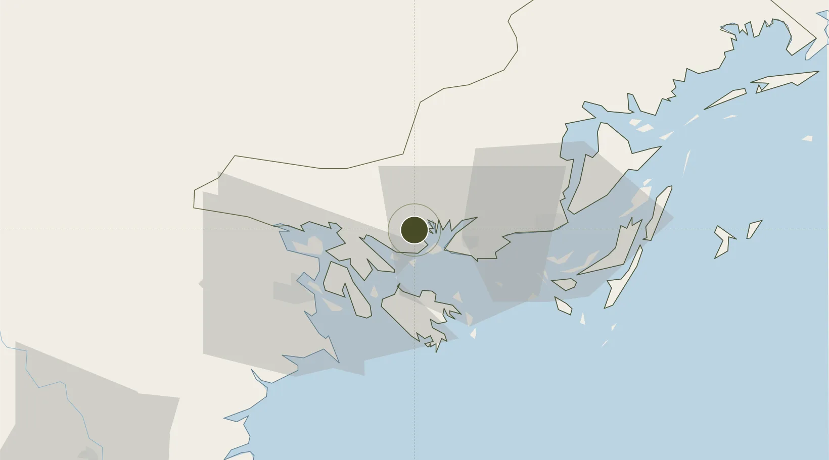
Nearby Logistics Neighbours

Ports
  1. 1Hon Gai10 km
  2. 2Hai Phong34 km
  3. 3Cam Pha39 km
  4. 4Fang-Cheng163 km
  5. 5Qinzhou183 km
Nearest neighbours — logibook spatial index (haversine) over the source coordinates
Airports
  1. 1Cat Bi International Airport35 km
  2. 2Van Don International Airport46 km
  3. 3Gia Lam Air Base115 km
  4. 4Baihe Ningming Air Base124 km
  5. 5Noi Bai International Airport125 km
Nearest neighbours — logibook spatial index (haversine) over the source coordinates
Cities
  1. 1Ha Long7 km
  2. 2Nam Hai Dinh Vu Port26 km
  3. 3Dinh Vu Terminal26 km
  4. 4Van Phong27 km
  5. 5Haiphong31 km
Nearest neighbours — logibook spatial index (haversine) over the source coordinates
Trade Zones
  1. 1Cái Lân Industrial Park7 km
  2. 2Dinh Vu Industrial Zone30 km
  3. 3Dinh Vu - Cat Hai Economic Zone30 km
  4. 4Do Son Industrial Zone38 km
  5. 5Nomura Industrial Zone43 km
Nearest neighbours — logibook spatial index (haversine) over the source coordinates
DatabookThe Record of Consolidated Knowledge
Vietnam beyond logistics?
Browse databook

All Sources

Trade ZonesOpen Zone Map
CC BY
Portsthe NGA World Port Index
Public domain (US gov)
AirportsOurAirports
Public domain
LocationsUN/LOCODE
UN/LOCODE — free
← Vietnam trade zones