Foreign Trade Zone · United States

FTZ No. 115 Beaumont Active

30.0811°, -94.1979°
11.0 km
Nearest port
22.4 km
Nearest airport

Gateway access

Nearest neighbours — logibook spatial index (haversine) over the source coordinates

Zone profile

Zone type
Foreign Trade Zone
Open Zone Map
Region
Texas
Open Zone Map
Status
Active
Open Zone Map
Management
Public-Private Partnership
Open Zone Map
Operator
Foreign-Trade Zone of Southeast Texas, Inc.
Open Zone Map
Legal framework
Foreign-Trade Zones Act
Open Zone Map

Location

Location of ozm-4892
Natural Earth 10m (public domain) · Texas · ozm-4892 · 30.08, -94.20GoogleOSMYandex

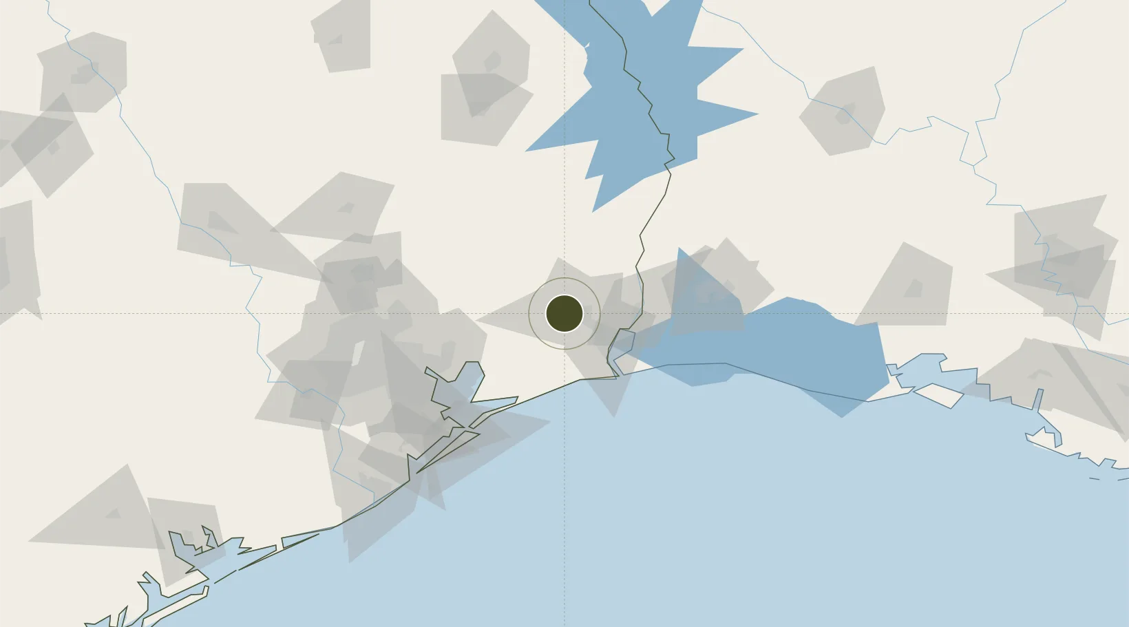
Nearby Logistics Neighbours

Ports
  1. 1Beaumont11 km
  2. 2Port Neches26 km
  3. 3Port Arthur35 km
  4. 4Orange45 km
  5. 5Sabine Pass48 km
Nearest neighbours — logibook spatial index (haversine) over the source coordinates
Airports
  1. 1Jack Brooks Regional Airport22 km
  2. 2Lake Charles Regional Airport94 km
  3. 3Ellington Airport107 km
  4. 4George Bush Intercontinental Airport111 km
  5. 5Scholes International At Galveston Airport111 km
Nearest neighbours — logibook spatial index (haversine) over the source coordinates
Cities
  1. 1Amelia2 km
  2. 2China14 km
  3. 3Vidor21 km
  4. 4Groves32 km
  5. 5Kountze34 km
Nearest neighbours — logibook spatial index (haversine) over the source coordinates
Trade Zones
  1. 1FTZ No. 116 Port Arthur29 km
  2. 2FTZ No. 117 Orange32 km
  3. 3FTZ No. 291 Cameron Parish70 km
  4. 4FTZ No. 087 Lake Charles81 km
  5. 5FTZ No. 171 Liberty County86 km
Nearest neighbours — logibook spatial index (haversine) over the source coordinates
DatabookThe Record of Consolidated Knowledge
United States beyond logistics?
Browse databook

All Sources

Trade ZonesOpen Zone Map
CC BY
Portsthe NGA World Port Index
Public domain (US gov)
AirportsOurAirports
Public domain
LocationsUN/LOCODE
UN/LOCODE — free
← United States trade zones