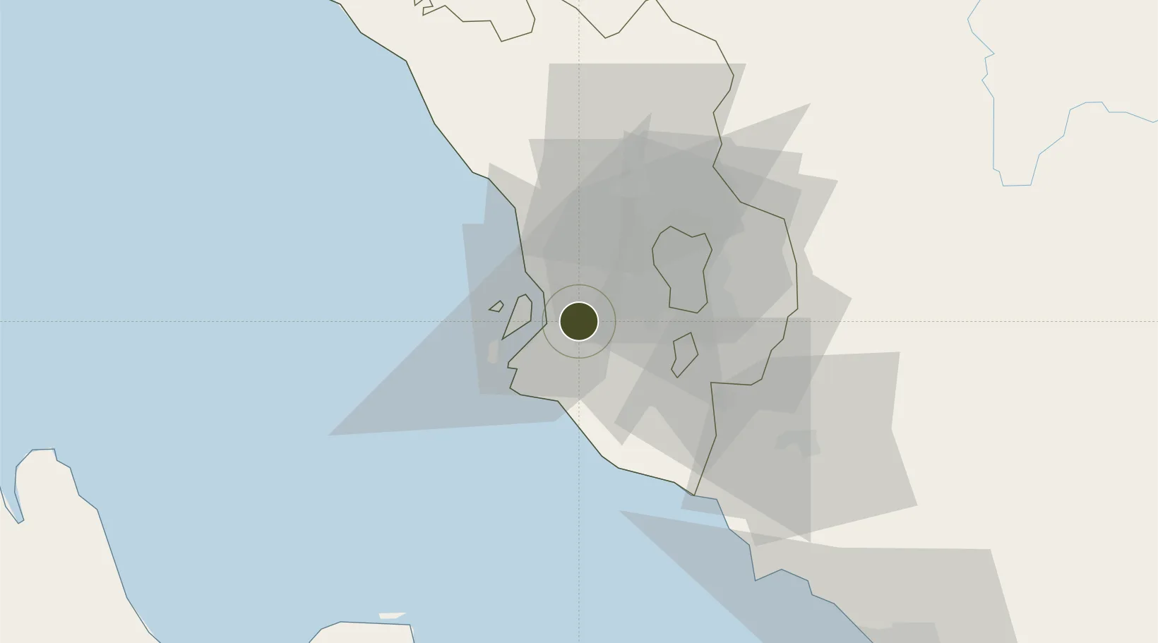
Free Trade Zone · Malaysia

Southpoint Free Zone Active

3.0072°, 101.4490°
95 ha
Zone area
5.5 km
Nearest port
17.7 km
Nearest airport

Gateway access

Nearest neighbours — logibook spatial index (haversine) over the source coordinates

Zone profile

Zone type
Free Trade Zone
Open Zone Map
Region
Selangor
Open Zone Map
Status
Active
Open Zone Map
Management
Public
Open Zone Map
Operator
Port Klang Authority
Open Zone Map
Legal framework
Free Zones Act of 1990 (Act 438)
Open Zone Map

Location

Location of ozm-2799
Natural Earth 10m (public domain) · Selangor · ozm-2799 · 3.01, 101.45GoogleOSMYandex

Nearby Logistics Neighbours

Ports
  1. 1Port Klang6 km
  2. 2Port Dickson65 km
  3. 3Pelabuhan Sungai Udang113 km
  4. 4Teluk Anson122 km
  5. 5Melaka126 km
Nearest neighbours — logibook spatial index (haversine) over the source coordinates
Airports
  1. 1Sultan Abdul Aziz Shah International Airport18 km
  2. 2Kuala Lumpur International Airport41 km
  3. 3Malacca International Airport122 km
  4. 4Pinang Kampai Airport156 km
  5. 5Pulau Pangkor Airport170 km
Nearest neighbours — logibook spatial index (haversine) over the source coordinates
Cities
  1. 1Klang3 km
  2. 2Port Klang (Pelabuhan Klang)7 km
  3. 3Port Klang (Ferry Port)9 km
  4. 4Bukit Raja11 km
  5. 5Carey Island Estate11 km
Nearest neighbours — logibook spatial index (haversine) over the source coordinates
Trade Zones
  1. 1Bukit Raja Industrial Park7 km
  2. 2Northport Free Zone10 km
  3. 3Telok Panglima Garang Free Industrial Zone10 km
  4. 4Selangor Bio Bay (Sbb)13 km
  5. 5Selangor Halal Hub Pulau Indah (Shh)13 km
Nearest neighbours — logibook spatial index (haversine) over the source coordinates
DatabookThe Record of Consolidated Knowledge
Malaysia beyond logistics?
Browse databook

All Sources

Trade ZonesOpen Zone Map
CC BY
Portsthe NGA World Port Index
Public domain (US gov)
AirportsOurAirports
Public domain
LocationsUN/LOCODE
UN/LOCODE — free
← Malaysia trade zones