UN/LOCODE hub · Malaysia
MYBRJ

Bukit Raja

3.1000°, 101.4333°
2
Transport functions

Transport Functions

Rail
Road
UN/LOCODE

Hub Profile

Region
10
GeoNames

Location

Location of MYBRJ
Natural Earth 10m (public domain) · 10 · MYBRJ · 3.10, 101.43GoogleOSMYandex

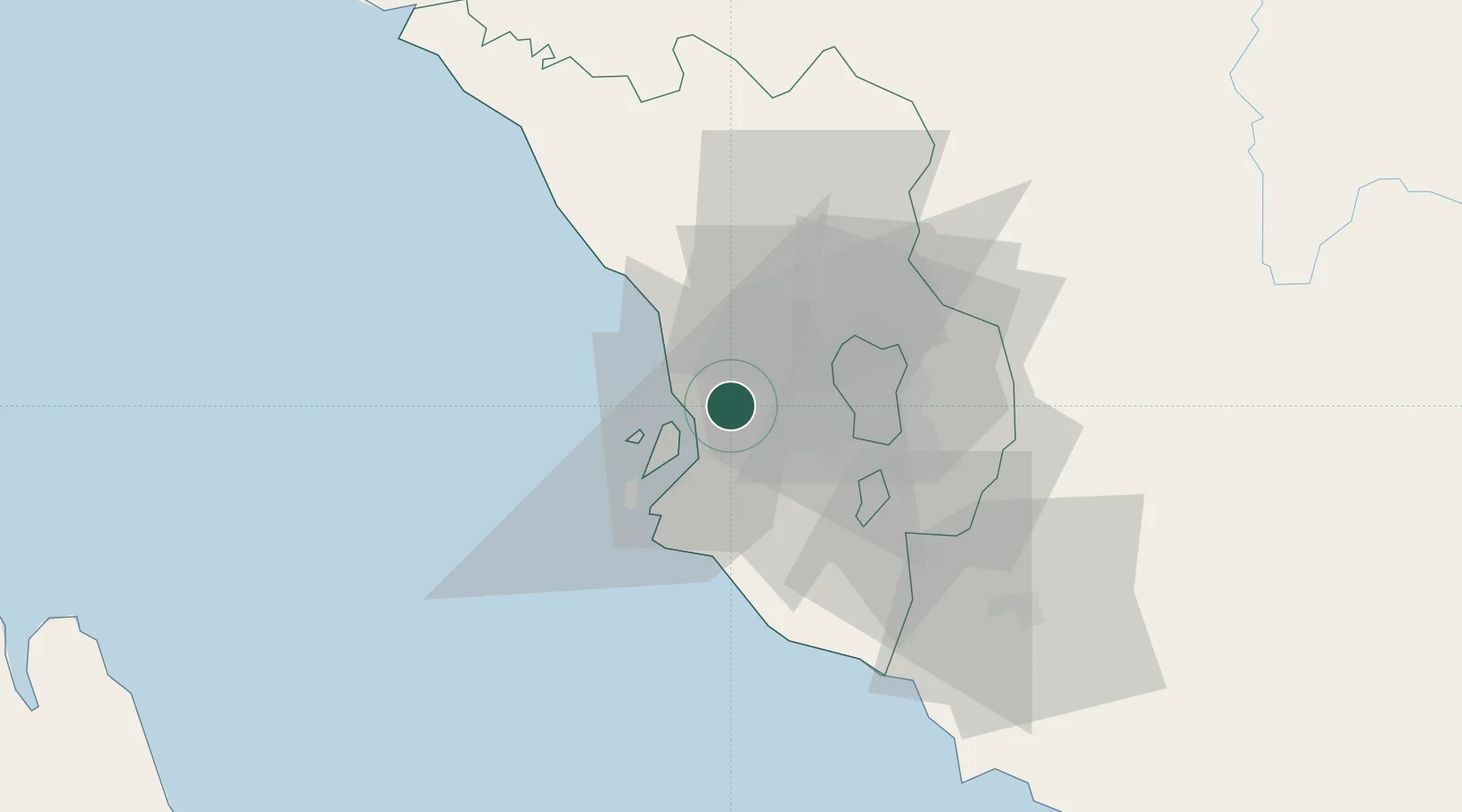
Nearby Logistics Neighbours

Cities
  1. 1Klang8 km
  2. 2Port Klang (Ferry Port)12 km
  3. 3Port Klang (Pelabuhan Klang)12 km
  4. 4Subang Jaya17 km
  5. 5Pulau Indah18 km
Nearest neighbours — logibook spatial index (haversine) over the source coordinates
Ports
  1. 1Port Klang12 km
  2. 2Port Dickson74 km
  3. 3Teluk Anson112 km
  4. 4Pelabuhan Sungai Udang122 km
  5. 5Melaka135 km
Nearest neighbours — logibook spatial index (haversine) over the source coordinates
Airports
  1. 1Sultan Abdul Aziz Shah International Airport13 km
  2. 2Kuala Lumpur International Airport50 km
  3. 3Malacca International Airport130 km
  4. 4Pulau Pangkor Airport161 km
  5. 5Pinang Kampai Airport166 km
Nearest neighbours — logibook spatial index (haversine) over the source coordinates
Trade Zones
  1. 1Bukit Raja Industrial Park5 km
  2. 2Southpoint Free Zone11 km
  3. 3Northport Free Zone12 km
  4. 4Eco Business Park V14 km
  5. 5Selangor Halal Hub Pulau Indah (Shh)18 km
Nearest neighbours — logibook spatial index (haversine) over the source coordinates
DatabookThe Record of Consolidated Knowledge
Malaysia beyond logistics?
Browse databook

All Sources

LocationsUN/LOCODE
UN/LOCODE — free
Portsthe NGA World Port Index
Public domain (US gov)
AirportsOurAirports
Public domain
Trade Zonesthe World Bank SEZ database
CC BY 4.0
Trade ZonesOpen Zone Map
CC BY
← Malaysia locations