Charter City · Kenya

Konza Technopolis Special Economic Zone Under Development
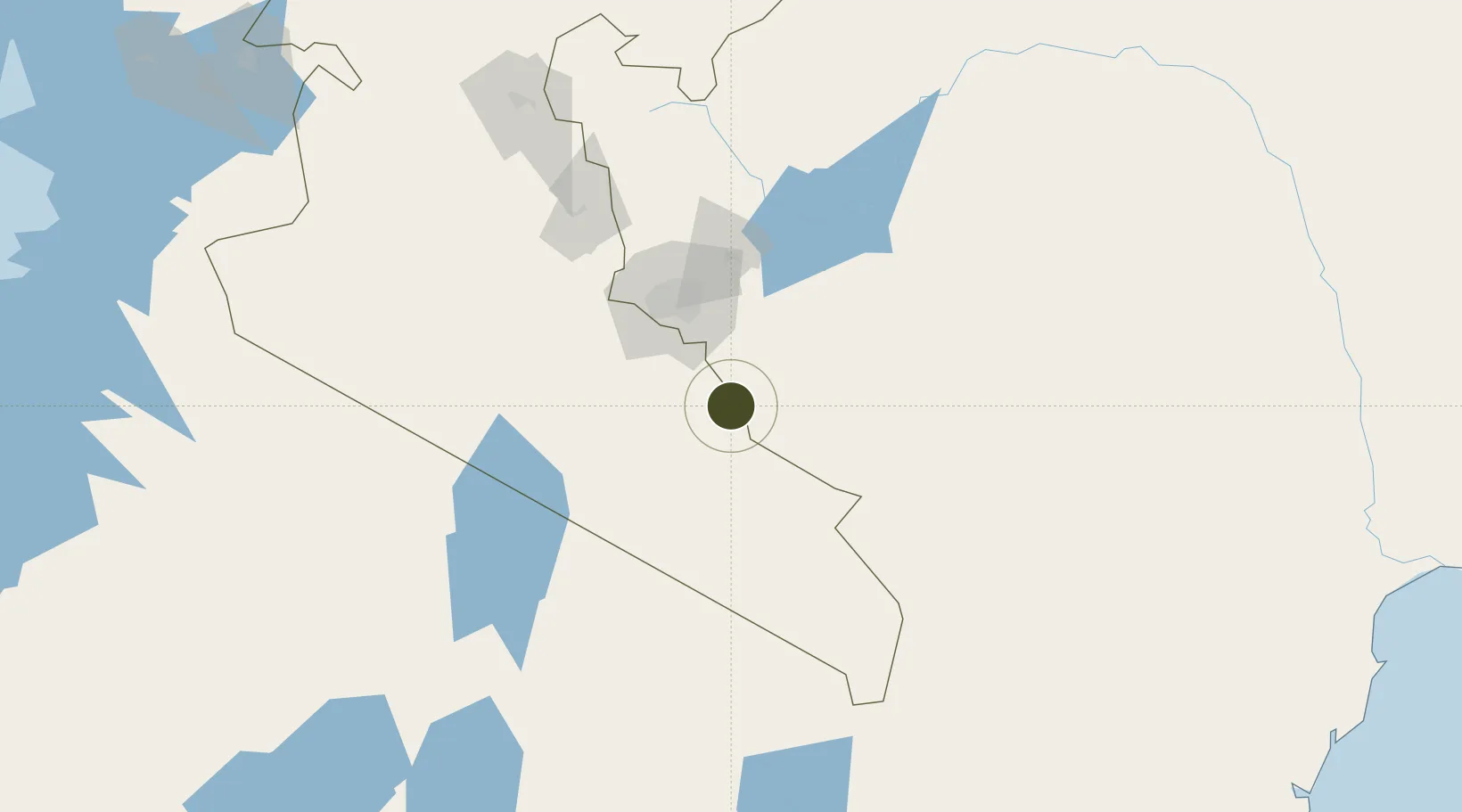
-1.7600°, 37.0953°
404 ha
Zone area
371.7 km
Nearest port
52.4 km
Nearest airport

Gateway access

Nearest neighbours — logibook spatial index (haversine) over the source coordinates

Zone profile

Zone type
Charter City
Open Zone Map
Region
Rift Valley
Open Zone Map
Status
Under Development
Open Zone Map
Management
Public
Open Zone Map
Operator
SEZ Authority, Konza Technopolis Development Authority
Open Zone Map
Legal framework
Special Economic Zones Act No. 16 of 2015
Open Zone Map

Location

Location of ozm-2652
Natural Earth 10m (public domain) · Rift Valley · ozm-2652 · -1.76, 37.10GoogleOSMYandex

Nearby Logistics Neighbours

Ports
  1. 1Kilifi372 km
  2. 2Malindi374 km
  3. 3Mombasa384 km
  4. 4Lamu427 km
  5. 5Tanga432 km
Nearest neighbours — logibook spatial index (haversine) over the source coordinates
Airports
  1. 1Jomo Kenyatta International Airport52 km
  2. 2Nairobi Wilson Airport58 km
  3. 3Moi Air Base60 km
  4. 4Amboseli Airport100 km
  5. 5Kilimanjaro International Airport185 km
Nearest neighbours — logibook spatial index (haversine) over the source coordinates
Cities
  1. 1Nairobi53 km
  2. 2Naivasha137 km
  3. 3Mwingi142 km
  4. 4Moshi179 km
  5. 5Siaya373 km
Nearest neighbours — logibook spatial index (haversine) over the source coordinates
Trade Zones
  1. 1Ahti River Export Processing Zone35 km
  2. 2Compact Free Trade Zone53 km
  3. 3Northlands Special Economic Zone66 km
  4. 4Tatu City Special Economic Zone72 km
  5. 5Oserian Two Lakes Industrial Park131 km
Nearest neighbours — logibook spatial index (haversine) over the source coordinates
DatabookThe Record of Consolidated Knowledge
Kenya beyond logistics?
Browse databook

All Sources

Trade ZonesOpen Zone Map
CC BY
Portsthe NGA World Port Index
Public domain (US gov)
AirportsOurAirports
Public domain
LocationsUN/LOCODE
UN/LOCODE — free
← Kenya trade zones