Specialized Zone · Gabon

Nkok Special Economic Zone Active
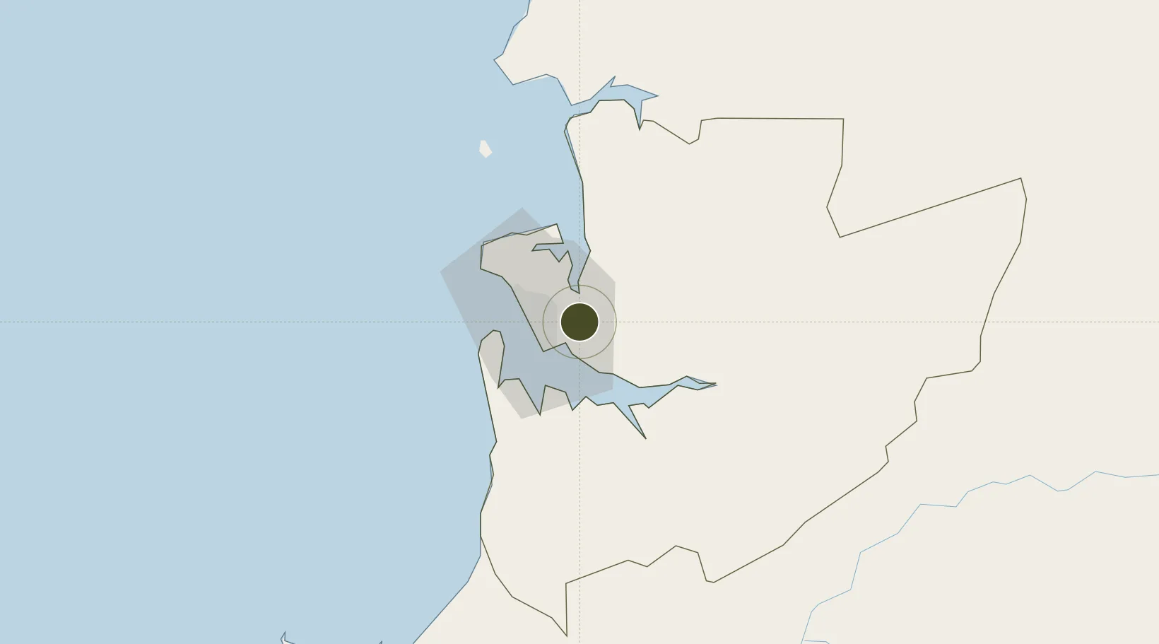
0.3815°, 9.6089°
1,126 ha
Zone area
16.3 km
Nearest port
23.5 km
Nearest airport

Gateway access

Nearest neighbours — logibook spatial index (haversine) over the source coordinates

Zone profile

Zone type
Specialized Zone
Open Zone Map
Specialization
Agriculture
Open Zone Map
Region
Estuaire
Open Zone Map
Status
Active
Open Zone Map
Management
Public-Private Partnership
Open Zone Map
Operator
Olam International Ltd, GSEZ
Open Zone Map
Legal framework
Decree No. 0461/PR/MPITPTHTAT of 10 October 2012
Open Zone Map

Location

Location of ozm-2029
Natural Earth 10m (public domain) · Estuaire · ozm-2029 · 0.38, 9.61GoogleOSMYandex

Nearby Logistics Neighbours

Ports
  1. 1Port Owendo16 km
  2. 2Libreville18 km
  3. 3Cogo79 km
  4. 4Port Gentil150 km
  5. 5Cap Lopez150 km
Nearest neighbours — logibook spatial index (haversine) over the source coordinates
Airports
  1. 1Libreville Leon M'ba International Airport24 km
  2. 2Corisco International Airport67 km
  3. 3Lambarene Airport140 km
  4. 4Port Gentil International Airport154 km
  5. 5Bata International Airport171 km
Nearest neighbours — logibook spatial index (haversine) over the source coordinates
Cities
  1. 1Libreville15 km
  2. 2Owendo16 km
  3. 3Equata75 km
  4. 4Port Gentil152 km
  5. 5Bata161 km
Nearest neighbours — logibook spatial index (haversine) over the source coordinates
Trade Zones
  1. 1Owendo Mineral Port16 km
  2. 2Gabon New International Airport Free Zone24 km
  3. 3Port-Gentil (Mandji) Special Economic Zone151 km
  4. 4Puerto de Bata Free Port161 km
  5. 5Baía das Agulhas Free Zone286 km
Nearest neighbours — logibook spatial index (haversine) over the source coordinates
DatabookThe Record of Consolidated Knowledge
Gabon beyond logistics?
Browse databook

All Sources

Trade ZonesOpen Zone Map
CC BY
Portsthe NGA World Port Index
Public domain (US gov)
AirportsOurAirports
Public domain
LocationsUN/LOCODE
UN/LOCODE — free
← Gabon trade zones