Export Processing Zone · Gabon

Gabon New International Airport Free Zone Active
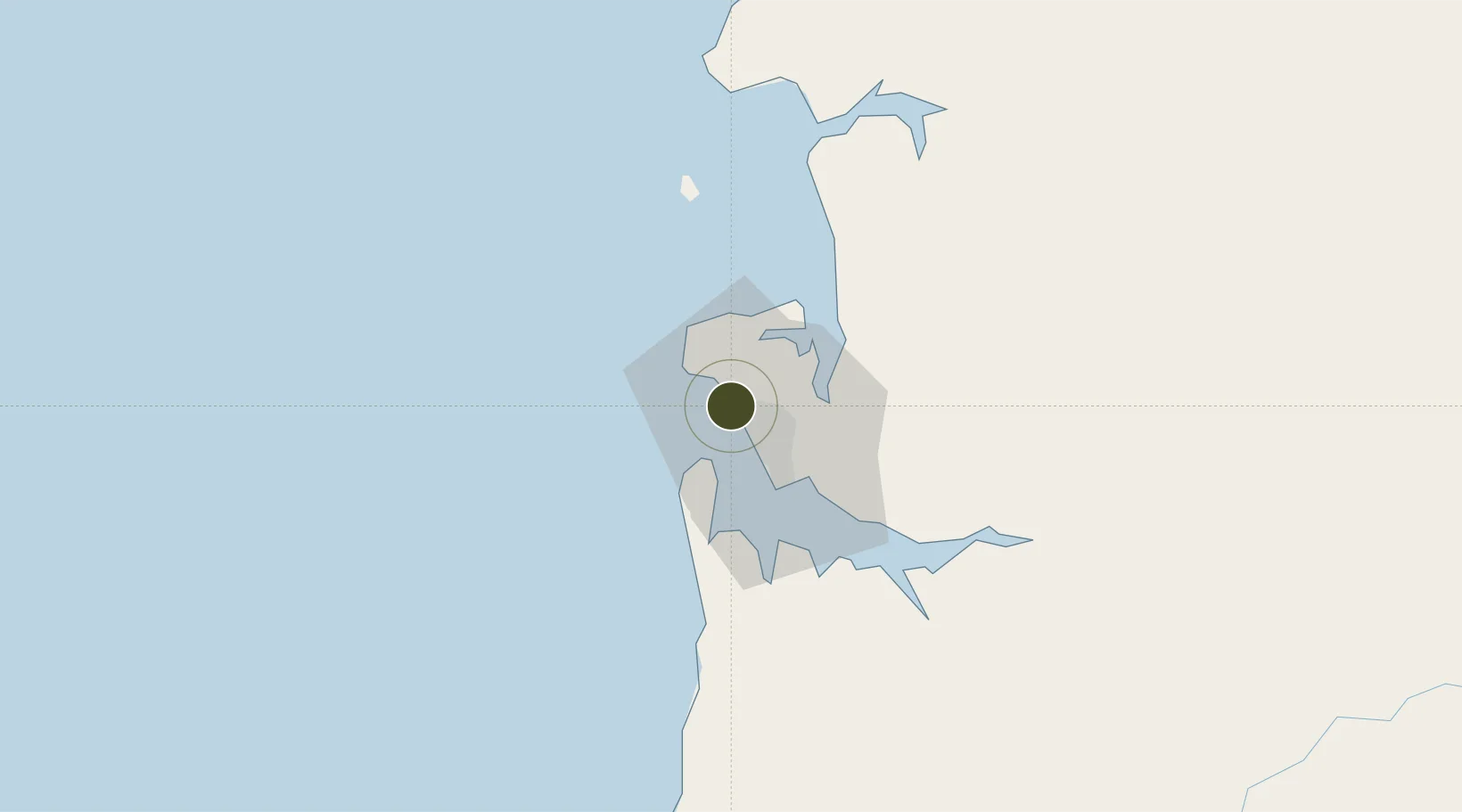
0.4629°, 9.4063°
4,278 ha
Zone area
10.1 km
Nearest port
0.8 km
Nearest airport

Gateway access

Nearest neighbours — logibook spatial index (haversine) over the source coordinates

Zone profile

Zone type
Export Processing Zone
Open Zone Map
Region
Estuaire
Open Zone Map
Status
Active
Open Zone Map
Management
Public-Private Partnership
Open Zone Map
Operator
Olam International Ltd, Gabonese Government, Africa Finance Corporation
Open Zone Map
Legal framework
Decree 0931/PR for Law No. 010/2011 on Special Economic Zones
Open Zone Map

Location

Location of ozm-2027
Natural Earth 10m (public domain) · Estuaire · ozm-2027 · 0.46, 9.41GoogleOSMYandex

Nearby Logistics Neighbours

Ports
  1. 1Libreville10 km
  2. 2Port Owendo23 km
  3. 3Cogo76 km
  4. 4Cap Lopez144 km
  5. 5Port Gentil146 km
Nearest neighbours — logibook spatial index (haversine) over the source coordinates
Airports
  1. 1Libreville Leon M'ba International Airport1 km
  2. 2Corisco International Airport51 km
  3. 3Port Gentil International Airport149 km
  4. 4Lambarene Airport160 km
  5. 5Bata International Airport166 km
Nearest neighbours — logibook spatial index (haversine) over the source coordinates
Cities
  1. 1Libreville18 km
  2. 2Owendo23 km
  3. 3Equata77 km
  4. 4Port Gentil147 km
  5. 5Bata156 km
Nearest neighbours — logibook spatial index (haversine) over the source coordinates
Trade Zones
  1. 1Owendo Mineral Port23 km
  2. 2Nkok Special Economic Zone24 km
  3. 3Port-Gentil (Mandji) Special Economic Zone147 km
  4. 4Puerto de Bata Free Port156 km
  5. 5Baía das Agulhas Free Zone262 km
Nearest neighbours — logibook spatial index (haversine) over the source coordinates
DatabookThe Record of Consolidated Knowledge
Gabon beyond logistics?
Browse databook

All Sources

Trade ZonesOpen Zone Map
CC BY
Portsthe NGA World Port Index
Public domain (US gov)
AirportsOurAirports
Public domain
LocationsUN/LOCODE
UN/LOCODE — free
← Gabon trade zones