Export Processing Zone · China

Jiangyin Economic Development Zone Active
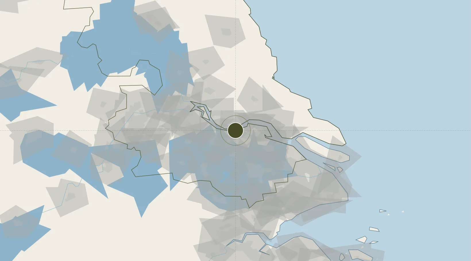
31.9207°, 120.2849°
2,590 ha
Zone area
4.9 km
Nearest port
42.7 km
Nearest airport

Gateway access

Nearest neighbours — logibook spatial index (haversine) over the source coordinates

Zone profile

Zone type
Export Processing Zone
Open Zone Map
Region
Jiangsu
Open Zone Map
Status
Active
Open Zone Map
Management
Public
Open Zone Map
Operator
Fuzhou Jiangyin Industrial Concentration District Management Committee
Open Zone Map
Legal framework
The People's Government of Fuzhou City: Your city's Request for Instructions on Jiangyin Economic Development Zone, Fuqing, Fujian (Rongzheng Integrated [2006] No. 46) has been received. According to the requirements of the National Development and Reform
Open Zone Map

Location

Location of ozm-1384
Natural Earth 10m (public domain) · Jiangsu · ozm-1384 · 31.92, 120.28GoogleOSMYandex

Nearby Logistics Neighbours

Ports
  1. 1Jiangyin5 km
  2. 2Zhangjiangang12 km
  3. 3Changzhou29 km
  4. 4Nantong49 km
  5. 5Gaogang58 km
Nearest neighbours — logibook spatial index (haversine) over the source coordinates
Airports
  1. 1Rugao Air Base43 km
  2. 2Changzhou Benniu International Airport48 km
  3. 3Sunan Shuofang International Airport49 km
  4. 4Nantong Xingdong International Airport68 km
  5. 5Suzhou Guangfu Airport74 km
Nearest neighbours — logibook spatial index (haversine) over the source coordinates
Cities
  1. 1Chengxi5 km
  2. 2Jiangyin Pt8 km
  3. 3Wuxi10 km
  4. 4Jingjiang13 km
  5. 5Zhangjiagang17 km
Nearest neighbours — logibook spatial index (haversine) over the source coordinates
DatabookThe Record of Consolidated Knowledge
China beyond logistics?
Browse databook

All Sources

Trade ZonesOpen Zone Map
CC BY
Portsthe NGA World Port Index
Public domain (US gov)
AirportsOurAirports
Public domain
LocationsUN/LOCODE
UN/LOCODE — free
← China trade zones