Diversified Zone · China

Jingjiang Economic Development Zone Active

32.0590°, 120.4118°
2,500 ha
Zone area
10.3 km
Nearest port
23.7 km
Nearest airport

Gateway access

Nearest neighbours — logibook spatial index (haversine) over the source coordinates

Zone profile

Zone type
Diversified Zone
Open Zone Map
Region
Jiangsu
Open Zone Map
Status
Active
Open Zone Map
Management
Public
Open Zone Map
Operator
Jingjiang Economic Development Management Committee
Open Zone Map
Legal framework
In 1993 jiangsu Provincial economic development zone was established with the approval of jiangsu Provincial people's Government
Open Zone Map

Location

Location of ozm-851
Natural Earth 10m (public domain) · Jiangsu · ozm-851 · 32.06, 120.41GoogleOSMYandex

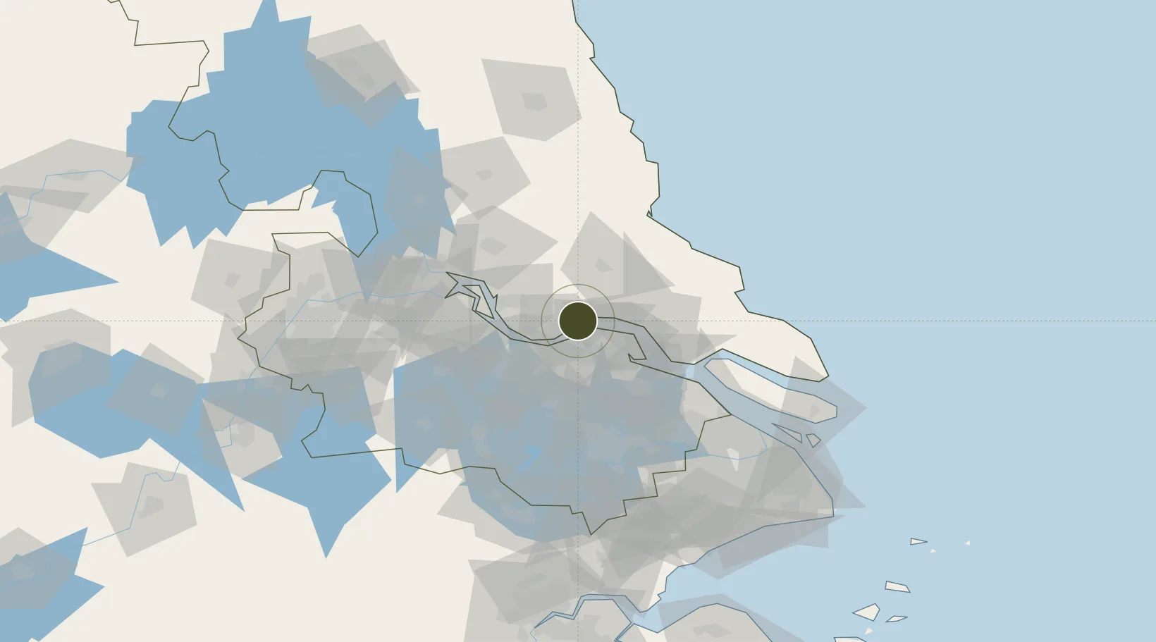
Nearby Logistics Neighbours

Ports
  1. 1Zhangjiangang10 km
  2. 2Jiangyin23 km
  3. 3Nantong37 km
  4. 4Changzhou42 km
  5. 5Gaogang59 km
Nearest neighbours — logibook spatial index (haversine) over the source coordinates
Airports
  1. 1Rugao Air Base24 km
  2. 2Nantong Xingdong International Airport54 km
  3. 3Changzhou Benniu International Airport62 km
  4. 4Sunan Shuofang International Airport63 km
  5. 5Yangzhou Taizhou Airport86 km
Nearest neighbours — logibook spatial index (haversine) over the source coordinates
Cities
  1. 1Jingjiang12 km
  2. 2Zhangjiagang13 km
  3. 3Rugao16 km
  4. 4Chengxi23 km
  5. 5Jiangyin Pt26 km
Nearest neighbours — logibook spatial index (haversine) over the source coordinates
DatabookThe Record of Consolidated Knowledge
China beyond logistics?
Browse databook

All Sources

Trade ZonesOpen Zone Map
CC BY
Portsthe NGA World Port Index
Public domain (US gov)
AirportsOurAirports
Public domain
LocationsUN/LOCODE
UN/LOCODE — free
← China trade zones