UN/LOCODE hub · South Africa
ZAZDV

North Riding

-26.3500°, 28.0333°
1
Transport functions

Transport Functions

Multimodal
UN/LOCODE

Hub Profile

Place type
Populated place
GeoNames
Region
Gauteng
GeoNames
Time zone
Africa/Johannesburg
GeoNames
Elevation
1,490 m
GeoNames

Location

Location of ZAZDV
Natural Earth 10m (public domain) · Gauteng · ZAZDV · -26.35, 28.03GoogleOSMYandex

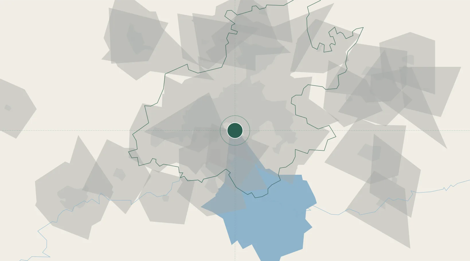
Nearby Logistics Neighbours

Cities
  1. 1Langlaagte3 km
  2. 2Amalgam3 km
  3. 3Eikenhof7 km
  4. 4Berea8 km
  5. 5Rosettenville11 km
Nearest neighbours — logibook spatial index (haversine) over the source coordinates
Ports
  1. 1Maputo452 km
  2. 2Richards Bay485 km
  3. 3Durban491 km
  4. 4East London743 km
  5. 5Inhambane789 km
Nearest neighbours — logibook spatial index (haversine) over the source coordinates
Airports
  1. 1Rand Airport17 km
  2. 2Vereeniging Airport25 km
  3. 3O.R. Tambo International Airport32 km
  4. 4Grand Central Airport42 km
  5. 5Lanseria International Airport47 km
Nearest neighbours — logibook spatial index (haversine) over the source coordinates
Trade Zones
  1. 1OR Tambo Industrial Development Zone33 km
  2. 2Vaal Special Economic Zone44 km
  3. 3Tshwane Automotive Industrial Zone75 km
  4. 4Babelegi Industrial Park113 km
  5. 5Bojanala (Platinum Valley) Special Economic Zone142 km
Nearest neighbours — logibook spatial index (haversine) over the source coordinates
DatabookThe Record of Consolidated Knowledge
South Africa beyond logistics?
Browse databook

All Sources

LocationsUN/LOCODE
UN/LOCODE — free
Portsthe NGA World Port Index
Public domain (US gov)
AirportsOurAirports
Public domain
Trade Zonesthe World Bank SEZ database
CC BY 4.0
Trade ZonesOpen Zone Map
CC BY
← South Africa locations