UN/LOCODE hub · United States
USOWY

Conway

45.4167°, -84.8667°
204
Population
2
Transport functions

Transport Functions

Rail
Road
UN/LOCODE

Hub Profile

Place type
Populated place
GeoNames
Region
Michigan
GeoNames
Population
204
GeoNames
Time zone
America/Detroit
GeoNames
Elevation
185 m
GeoNames

Location

Location of USOWY
Natural Earth 10m (public domain) · Michigan · USOWY · 45.42, -84.87GoogleOSMYandex

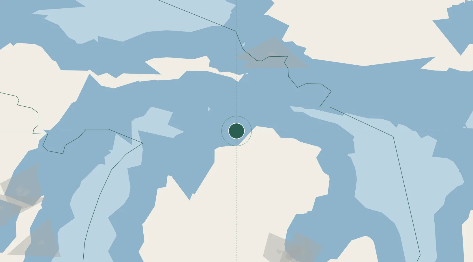
Nearby Logistics Neighbours

Cities
  1. 1Alanson7 km
  2. 2Harbor Springs9 km
  3. 3Pellston16 km
  4. 4Boyne City25 km
  5. 5Boyne Falls28 km
Nearest neighbours — logibook spatial index (haversine) over the source coordinates
Ports
  1. 1Harbor Springs9 km
  2. 2Petoskey10 km
  3. 3Charlevoix33 km
  4. 4Cheboygan41 km
  5. 5Mackinaw City42 km
Nearest neighbours — logibook spatial index (haversine) over the source coordinates
Airports
  1. 1Pellston Regional Airport of Emmet County Airport18 km
  2. 2Charlevoix Municipal Airport34 km
  3. 3Welke Airport61 km
  4. 4Beaver Island Airport63 km
  5. 5Cherry Capital Airport94 km
Nearest neighbours — logibook spatial index (haversine) over the source coordinates
Trade Zones
  1. 1FTZ No. 016 Sault Ste. Marie124 km
  2. 2FTZ No. 189 Kent Ottawa/Muskegon Counties268 km
  3. 3FTZ No. 101 Clinton County275 km
  4. 4FTZ No. 284 Genesee County278 km
  5. 5FTZ No. 019 Omaha279 km
Nearest neighbours — logibook spatial index (haversine) over the source coordinates
DatabookThe Record of Consolidated Knowledge
United States beyond logistics?
Browse databook

All Sources

LocationsUN/LOCODE
UN/LOCODE — free
LocationsGeoNames
CC BY 4.0
Portsthe NGA World Port Index
Public domain (US gov)
AirportsOurAirports
Public domain
Trade Zonesthe World Bank SEZ database
CC BY 4.0
Trade ZonesOpen Zone Map
CC BY
← United States locations