UN/LOCODE hub · United States
USNCF

North Chelmsford

42.6333°, -71.3833°
2
Transport functions

Transport Functions

Rail
Road
UN/LOCODE

Hub Profile

Place type
Populated place
GeoNames
Region
Massachusetts
GeoNames
Time zone
America/New_York
GeoNames
Elevation
37 m
GeoNames

Location

Location of USNCF
Natural Earth 10m (public domain) · Massachusetts · USNCF · 42.63, -71.38GoogleOSMYandex

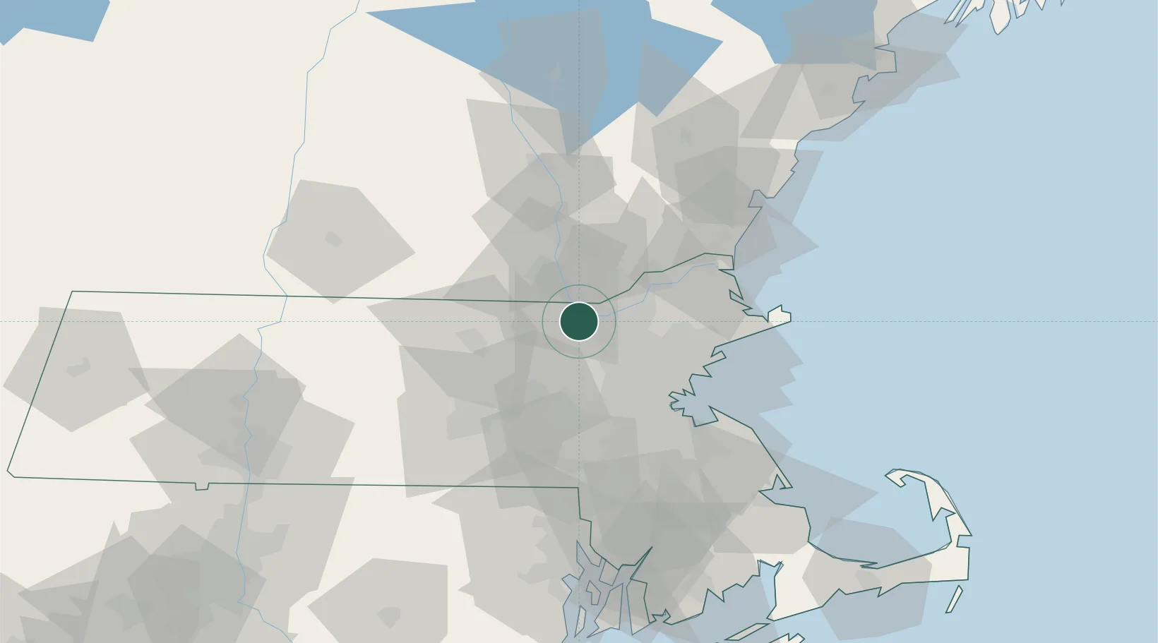
Nearby Logistics Neighbours

Cities
  1. 1Tyngsboro5 km
  2. 2Carlisle11 km
  3. 3Devenscrest18 km
  4. 4Boxboro20 km
  5. 5Concord21 km
Nearest neighbours — logibook spatial index (haversine) over the source coordinates
Ports
  1. 1Lynn41 km
  2. 2Boston42 km
  3. 3Beverly42 km
  4. 4Salem43 km
  5. 5Marblehead46 km
Nearest neighbours — logibook spatial index (haversine) over the source coordinates
Airports
  1. 1Laurence G Hanscom Field20 km
  2. 2Lawrence Municipal Airport23 km
  3. 3Manchester-Boston Regional Airport34 km
  4. 4Beverly Regional Airport39 km
  5. 5Boston Logan International Airport43 km
Nearest neighbours — logibook spatial index (haversine) over the source coordinates
Trade Zones
  1. 1FTZ No. 027 Boston42 km
  2. 2FTZ No. 081 Portsmouth64 km
  3. 3FTZ No. 105 Providence and North Kingstown91 km
  4. 4FTZ No. 268 Brattleboro103 km
  5. 5FTZ No. 028 New Bedford112 km
Nearest neighbours — logibook spatial index (haversine) over the source coordinates
DatabookThe Record of Consolidated Knowledge
United States beyond logistics?
Browse databook

All Sources

LocationsUN/LOCODE
UN/LOCODE — free
Portsthe NGA World Port Index
Public domain (US gov)
AirportsOurAirports
Public domain
Trade Zonesthe World Bank SEZ database
CC BY 4.0
Trade ZonesOpen Zone Map
CC BY
← United States locations