UN/LOCODE hub · United States
USIR2

Indian River City

28.5667°, -80.8000°
3
Transport functions

Transport Functions

Port
Road
Multimodal
UN/LOCODE

Hub Profile

Place type
Populated place
GeoNames
Region
Florida
GeoNames
Time zone
America/New_York
GeoNames
Elevation
3 m
GeoNames

Location

Location of USIR2
Natural Earth 10m (public domain) · Florida · USIR2 · 28.57, -80.80GoogleOSMYandex

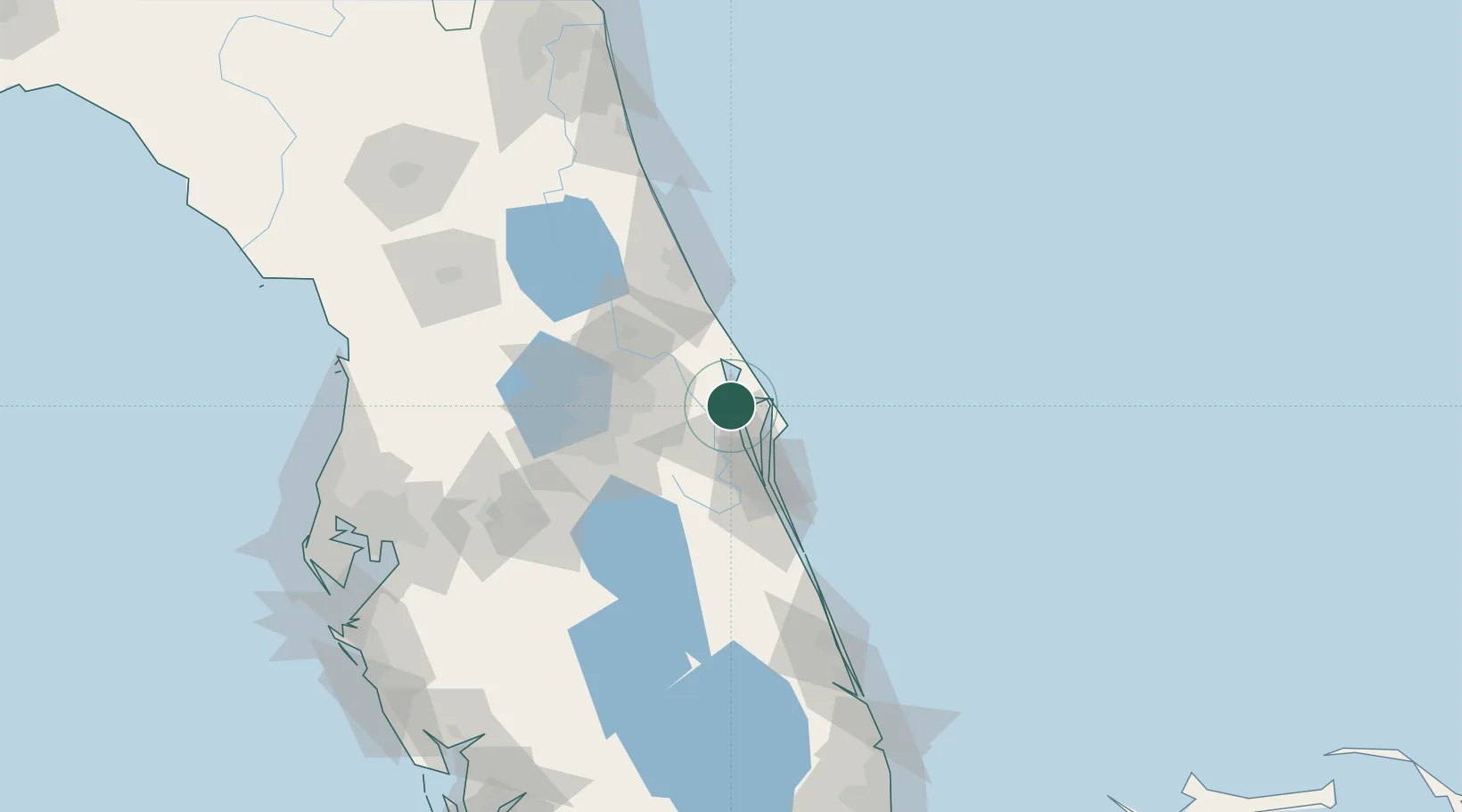
Nearby Logistics Neighbours

Cities
  1. 1Mims12 km
  2. 2John F Kennedy Space Center/Cape Canaveral15 km
  3. 3Port Canaveral25 km
  4. 4Cocoa Beach34 km
  5. 5Geneva36 km
Nearest neighbours — logibook spatial index (haversine) over the source coordinates
Ports
  1. 1Canaveral Harbor23 km
  2. 2Fort Pierce131 km
  3. 3St Augustine157 km
  4. 4Tampa177 km
  5. 5Tarpon Springs198 km
Nearest neighbours — logibook spatial index (haversine) over the source coordinates
Airports
  1. 1Space Coast Regional Airport6 km
  2. 2Space Florida Launch and Landing Facility12 km
  3. 3Cape Canaveral SFS Skid Strip25 km
  4. 4Patrick Space Force Base41 km
  5. 5Orlando Sanford International Airport48 km
Nearest neighbours — logibook spatial index (haversine) over the source coordinates
Trade Zones
  1. 1FTZ No. 136 Brevard County52 km
  2. 2FTZ No. 250 Seminole County58 km
  3. 3FTZ No. 042 Orlando70 km
  4. 4FTZ No. 198 Volusia County81 km
  5. 5FTZ No. 218 St. Lucie County134 km
Nearest neighbours — logibook spatial index (haversine) over the source coordinates
DatabookThe Record of Consolidated Knowledge
United States beyond logistics?
Browse databook

All Sources

LocationsUN/LOCODE
UN/LOCODE — free
Portsthe NGA World Port Index
Public domain (US gov)
AirportsOurAirports
Public domain
Trade Zonesthe World Bank SEZ database
CC BY 4.0
Trade ZonesOpen Zone Map
CC BY
← United States locations