UN/LOCODE hub · United States
USFTB

Fulton

36.5000°, -88.8667°
2,235
Population
2
Transport functions

Transport Functions

Rail
Road
UN/LOCODE

Hub Profile

Place type
Populated place
GeoNames
Region
Kentucky
GeoNames
Population
2,235
GeoNames
Time zone
America/Chicago
GeoNames
Elevation
110 m
GeoNames

Location

Location of USFTB
Natural Earth 10m (public domain) · Kentucky · USFTB · 36.50, -88.87GoogleOSMYandex

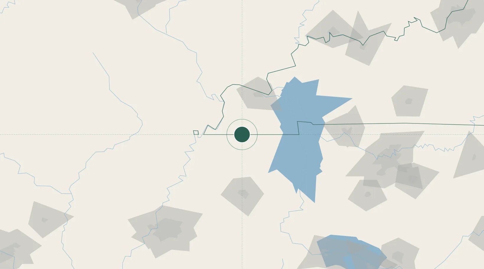
Nearby Logistics Neighbours

Cities
  1. 1Hickman29 km
  2. 2Farmington36 km
  3. 3Greenfield39 km
  4. 4Obion40 km
  5. 5Rutherford44 km
Nearest neighbours — logibook spatial index (haversine) over the source coordinates
Ports
  1. 1Port Of Memphis198 km
  2. 2Gary584 km
  3. 3Indiana Harbor588 km
  4. 4Calumet Harbor593 km
  5. 5Michigan City606 km
Nearest neighbours — logibook spatial index (haversine) over the source coordinates
Airports
  1. 1Barkley Regional Airport63 km
  2. 2McKellar-Sipes Regional Airport100 km
  3. 3Cape Girardeau Regional Airport102 km
  4. 4Arkansas International Airport114 km
  5. 5Campbell Army Airfield (Fort Campbell)125 km
Nearest neighbours — logibook spatial index (haversine) over the source coordinates
Trade Zones
  1. 1FTZ No. 294 Western Kentucky68 km
  2. 2FTZ No. 283 West Tennessee111 km
  3. 3FTZ No. 078 Nashville165 km
  4. 4FTZ No. 223 Memphis189 km
  5. 5FTZ No. 273 West Memphis192 km
Nearest neighbours — logibook spatial index (haversine) over the source coordinates
DatabookThe Record of Consolidated Knowledge
United States beyond logistics?
Browse databook

All Sources

LocationsUN/LOCODE
UN/LOCODE — free
LocationsGeoNames
CC BY 4.0
Portsthe NGA World Port Index
Public domain (US gov)
AirportsOurAirports
Public domain
Trade Zonesthe World Bank SEZ database
CC BY 4.0
Trade ZonesOpen Zone Map
CC BY
← United States locations