UN/LOCODE hub · Tanzania
TZKAG

Kagera

-4.6500°, 30.6667°
2
Transport functions

Transport Functions

Port
Multimodal
UN/LOCODE

Hub Profile

Place type
Populated place
GeoNames
Region
Kigoma
GeoNames
Time zone
Africa/Dar_es_Salaam
GeoNames
Elevation
1,082 m
GeoNames

Location

Location of TZKAG
Natural Earth 10m (public domain) · Kigoma · TZKAG · -4.65, 30.67GoogleOSMYandex

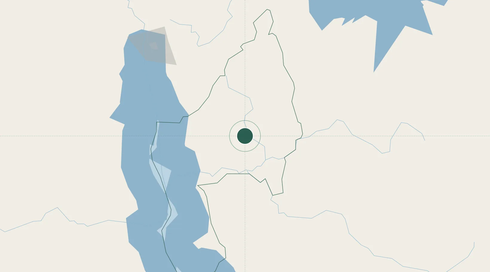
Nearby Logistics Neighbours

Cities
  1. 1Kasulu64 km
  2. 2Kasulu64 km
  3. 3Kibondo119 km
  4. 4Cibitoke206 km
  5. 5Mwanza343 km
Nearest neighbours — logibook spatial index (haversine) over the source coordinates
Ports
  1. 1Tanga937 km
  2. 2Zanzibar958 km
  3. 3Dar Es Salaam985 km
  4. 4Mombasa1000 km
  5. 5Kilifi1027 km
Nearest neighbours — logibook spatial index (haversine) over the source coordinates
Airports
  1. 1Kigoma Airport113 km
  2. 2Gitega Airport161 km
  3. 3Kalemie Airport208 km
  4. 4Bujumbura Melchior Ndadaye International Airport210 km
  5. 5Kirundo Airport243 km
Nearest neighbours — logibook spatial index (haversine) over the source coordinates
Trade Zones
  1. 1Kigoma Special Economic Zone113 km
  2. 2Warubonda Special Economic Zone215 km
  3. 3Huye Industrial Park254 km
  4. 4Bugesera Industrial Park286 km
  5. 5Rusizi Industrial Park292 km
Nearest neighbours — logibook spatial index (haversine) over the source coordinates
DatabookThe Record of Consolidated Knowledge
Tanzania beyond logistics?
Browse databook

All Sources

LocationsUN/LOCODE
UN/LOCODE — free
Portsthe NGA World Port Index
Public domain (US gov)
AirportsOurAirports
Public domain
Trade Zonesthe World Bank SEZ database
CC BY 4.0
Trade ZonesOpen Zone Map
CC BY
← Tanzania locations