UN/LOCODE hub · Thailand
THBNG

Bangnara

6.4333°, 101.8333°
1
Transport functions

Transport Functions

Port
UN/LOCODE

Hub Profile

Region
96
GeoNames

Location

Location of THBNG
Natural Earth 10m (public domain) · 96 · THBNG · 6.43, 101.83GoogleOSMYandex

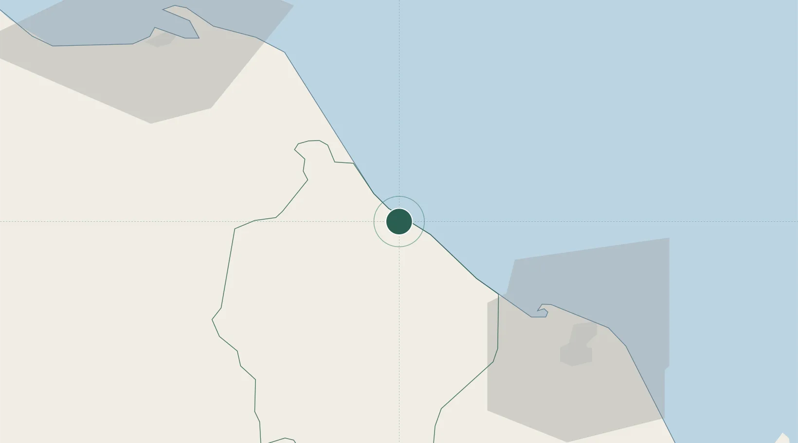
Nearby Logistics Neighbours

Cities
  1. 1Narathiwat3 km
  2. 2Tak Bai Customs House31 km
  3. 3Tanah Merah78 km
  4. 4Pattani80 km
  5. 5Kuala Besut105 km
Nearest neighbours — logibook spatial index (haversine) over the source coordinates
Ports
  1. 1Pattani82 km
  2. 2Songkhla Harbor163 km
  3. 3Kuala Trengganu188 km
  4. 4Pulau Pinang199 km
  5. 5Port Langkawi228 km
Nearest neighbours — logibook spatial index (haversine) over the source coordinates
Airports
  1. 1Narathiwat Airport14 km
  2. 2Sultan Ismail Petra Airport59 km
  3. 3Pattani Airport85 km
  4. 4Betong International Airport104 km
  5. 5Songkhla Airport159 km
Nearest neighbours — logibook spatial index (haversine) over the source coordinates
Trade Zones
  1. 1Pengkalan Kubor Free Zone36 km
  2. 2Duty Free Area At Pengkalan Kubor36 km
  3. 3Rantau Panjang Free Commercial Zone49 km
  4. 4East Coast Economic Region57 km
  5. 5Narathiwat Special Economic Zone78 km
Nearest neighbours — logibook spatial index (haversine) over the source coordinates
DatabookThe Record of Consolidated Knowledge
Thailand beyond logistics?
Browse databook

All Sources

LocationsUN/LOCODE
UN/LOCODE — free
Portsthe NGA World Port Index
Public domain (US gov)
AirportsOurAirports
Public domain
Trade Zonesthe World Bank SEZ database
CC BY 4.0
Trade ZonesOpen Zone Map
CC BY
← Thailand locations