UN/LOCODE hub · Philippines
PHARA

Aras Asan/Bislig

8.8833°, 126.3000°
1
Transport functions

Transport Functions

Port
UN/LOCODE

Hub Profile

Region
DAO
GeoNames

Location

Location of PHARA
Natural Earth 10m (public domain) · DAO · PHARA · 8.88, 126.30GoogleOSMYandex

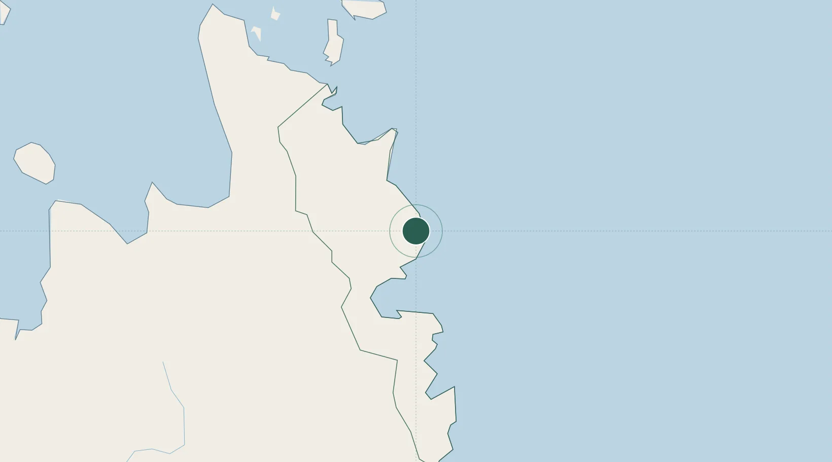
Nearby Logistics Neighbours

Cities
  1. 1Marihatag, Mindanao11 km
  2. 2Taganito91 km
  3. 3Gigaquit, Mindanao103 km
  4. 4Boston/Davao113 km
  5. 5Cagdianao134 km
Nearest neighbours — logibook spatial index (haversine) over the source coordinates
Ports
  1. 1Hinatuan58 km
  2. 2Mangagoy72 km
  3. 3Butuan City85 km
  4. 4Masao98 km
  5. 5Nasipit Port107 km
Nearest neighbours — logibook spatial index (haversine) over the source coordinates
Airports
  1. 1Tandag Airport25 km
  2. 2Bislig Airport77 km
  3. 3Bancasi Airport91 km
  4. 4Siargao Airport113 km
  5. 5Surigao Airport132 km
Nearest neighbours — logibook spatial index (haversine) over the source coordinates
Trade Zones
  1. 1Taguibo Agro-Industrial Zone77 km
  2. 2ITC Ecozone89 km
  3. 3Taganito Special Economic Zone91 km
  4. 4Tubay Agri-Processing Center97 km
  5. 5Nasipit Agusan del Norte Industrial Estate122 km
Nearest neighbours — logibook spatial index (haversine) over the source coordinates
DatabookThe Record of Consolidated Knowledge
Philippines beyond logistics?
Browse databook

All Sources

LocationsUN/LOCODE
UN/LOCODE — free
Portsthe NGA World Port Index
Public domain (US gov)
AirportsOurAirports
Public domain
Trade Zonesthe World Bank SEZ database
CC BY 4.0
Trade ZonesOpen Zone Map
CC BY
← Philippines locations