UN/LOCODE hub · Norway
NOVTS

Vats

59.4833°, 5.7333°
1
Transport functions

Transport Functions

Port
UN/LOCODE

Hub Profile

Region
11
GeoNames

Location

Location of NOVTS
Natural Earth 10m (public domain) · 11 · NOVTS · 59.48, 5.73GoogleOSMYandex

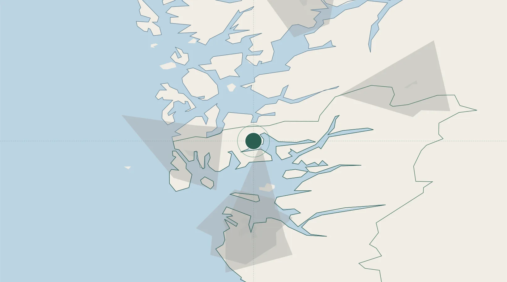
Nearby Logistics Neighbours

Cities
  1. 1Raunes - Vindafjord6 km
  2. 2Sandeid9 km
  3. 3Vikedal11 km
  4. 4Ølen14 km
  5. 5Osnes - Vindafjord15 km
Nearest neighbours — logibook spatial index (haversine) over the source coordinates
Ports
  1. 1Karsto27 km
  2. 2Haugesund28 km
  3. 3Mosterhamn31 km
  4. 4Kopervik32 km
  5. 5Leirvik33 km
Nearest neighbours — logibook spatial index (haversine) over the source coordinates
Airports
  1. 1Haugesund Airport, Karmøy33 km
  2. 2Stord Airport, Sørstokken41 km
  3. 3Stavanger Airport, Sola68 km
  4. 4Bergen Airport, Flesland95 km
  5. 5Kristiansand Airport196 km
Nearest neighbours — logibook spatial index (haversine) over the source coordinates
Trade Zones
  1. 1Gothenburg Boundless Customs Warehouse404 km
  2. 2Freeport of Kiel633 km
  3. 3Freeport of Cuxhaven (Freihafen Cuxhaven)652 km
  4. 4North Eastern Enterprise Zone669 km
  5. 5Tees Valley Enterprise Zone685 km
Nearest neighbours — logibook spatial index (haversine) over the source coordinates
DatabookThe Record of Consolidated Knowledge
Norway beyond logistics?
Browse databook

All Sources

LocationsUN/LOCODE
UN/LOCODE — free
Portsthe NGA World Port Index
Public domain (US gov)
AirportsOurAirports
Public domain
Trade Zonesthe World Bank SEZ database
CC BY 4.0
Trade ZonesOpen Zone Map
CC BY
← Norway locations