UN/LOCODE hub · Malaysia
MYKBD

Kota Belud, Sabah

6.3500°, 116.4333°
1
Transport functions

Transport Functions

Port
UN/LOCODE

Hub Profile

Region
12
GeoNames

Location

Location of MYKBD
Natural Earth 10m (public domain) · 12 · MYKBD · 6.35, 116.43GoogleOSMYandex

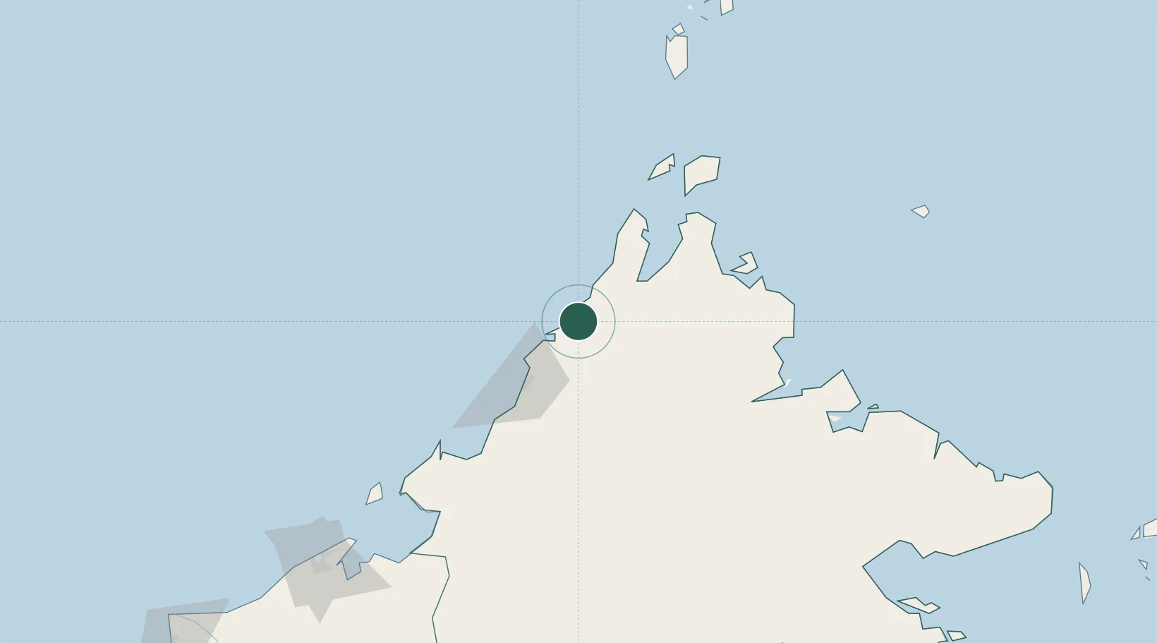
Nearby Logistics Neighbours

Cities
  1. 1Kota Marudu40 km
  2. 2Kota Kinabalu, Sabah44 km
  3. 3Bangau73 km
  4. 4Bedong89 km
  5. 5Kimanis, Sabah101 km
Nearest neighbours — logibook spatial index (haversine) over the source coordinates
Ports
  1. 1Kota Kinabalu58 km
  2. 2Kudat75 km
  3. 3Pelabuhan Sandakan195 km
  4. 4Muara Harbor211 km
  5. 5Bandar Seri Begawan237 km
Nearest neighbours — logibook spatial index (haversine) over the source coordinates
Airports
  1. 1Kota Kinabalu International Airport63 km
  2. 2Kudat Airport78 km
  3. 3Labuan Airport175 km
  4. 4Sandakan Airport187 km
  5. 5Lawas Airport202 km
Nearest neighbours — logibook spatial index (haversine) over the source coordinates
Trade Zones
  1. 1Sabah Development Corridor61 km
  2. 2Labuan Offshore Financial Centre177 km
  3. 3Muara Export Zone210 km
  4. 4Terunjing Free Trade Zone210 km
  5. 5Rio Tuba Export Processing Zone268 km
Nearest neighbours — logibook spatial index (haversine) over the source coordinates
DatabookThe Record of Consolidated Knowledge
Malaysia beyond logistics?
Browse databook

All Sources

LocationsUN/LOCODE
UN/LOCODE — free
Portsthe NGA World Port Index
Public domain (US gov)
AirportsOurAirports
Public domain
Trade Zonesthe World Bank SEZ database
CC BY 4.0
Trade ZonesOpen Zone Map
CC BY
← Malaysia locations