UN/LOCODE hub · Morocco
MAKZZ

Allal Tazi

34.5000°, -6.3167°
1
Transport functions

Transport Functions

Multimodal
UN/LOCODE

Hub Profile

Region
KEN
GeoNames

Location

Location of MAKZZ
Natural Earth 10m (public domain) · KEN · MAKZZ · 34.50, -6.32GoogleOSMYandex

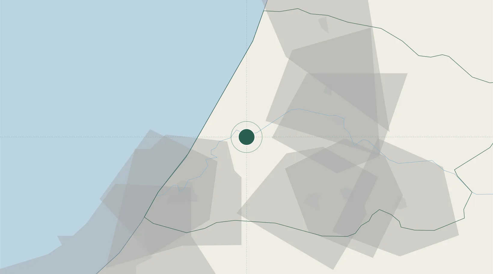
Nearby Logistics Neighbours

Cities
  1. 1Souq Larb'A Al Gharb37 km
  2. 2Salé68 km
  3. 3Skhirat98 km
  4. 4Ar Rommani112 km
  5. 5Aïn Harrouda142 km
Nearest neighbours — logibook spatial index (haversine) over the source coordinates
Ports
  1. 1Kenitra34 km
  2. 2Mohammedia132 km
  3. 3Tanger150 km
  4. 4Casablanca156 km
  5. 5Tangier-Mediterranean172 km
Nearest neighbours — logibook spatial index (haversine) over the source coordinates
Airports
  1. 1Kenitra Air Base34 km
  2. 2Rabat-Salé Airport64 km
  3. 3Bassatine Airport101 km
  4. 4Fes Saïss International Airport139 km
  5. 5Tangier Ibn Battuta Airport142 km
Nearest neighbours — logibook spatial index (haversine) over the source coordinates
Trade Zones
  1. 1Zona Franca Kenitra Atlantic22 km
  2. 2Kénitra Atlantic Free Zone22 km
  3. 3Technopolis68 km
  4. 4Meknès Agropolis108 km
  5. 5Fès Shore Industrial Park136 km
Nearest neighbours — logibook spatial index (haversine) over the source coordinates
DatabookThe Record of Consolidated Knowledge
Morocco beyond logistics?
Browse databook

All Sources

LocationsUN/LOCODE
UN/LOCODE — free
Portsthe NGA World Port Index
Public domain (US gov)
AirportsOurAirports
Public domain
Trade Zonesthe World Bank SEZ database
CC BY 4.0
Trade ZonesOpen Zone Map
CC BY
← Morocco locations