UN/LOCODE hub · South Korea
KRGSO

Goseong-gun

34.9667°, 128.3167°
2
Transport functions

Transport Functions

Rail
Road
UN/LOCODE

Hub Profile

Region
47
GeoNames

Location

Location of KRGSO
Natural Earth 10m (public domain) · 47 · KRGSO · 34.97, 128.32GoogleOSMYandex

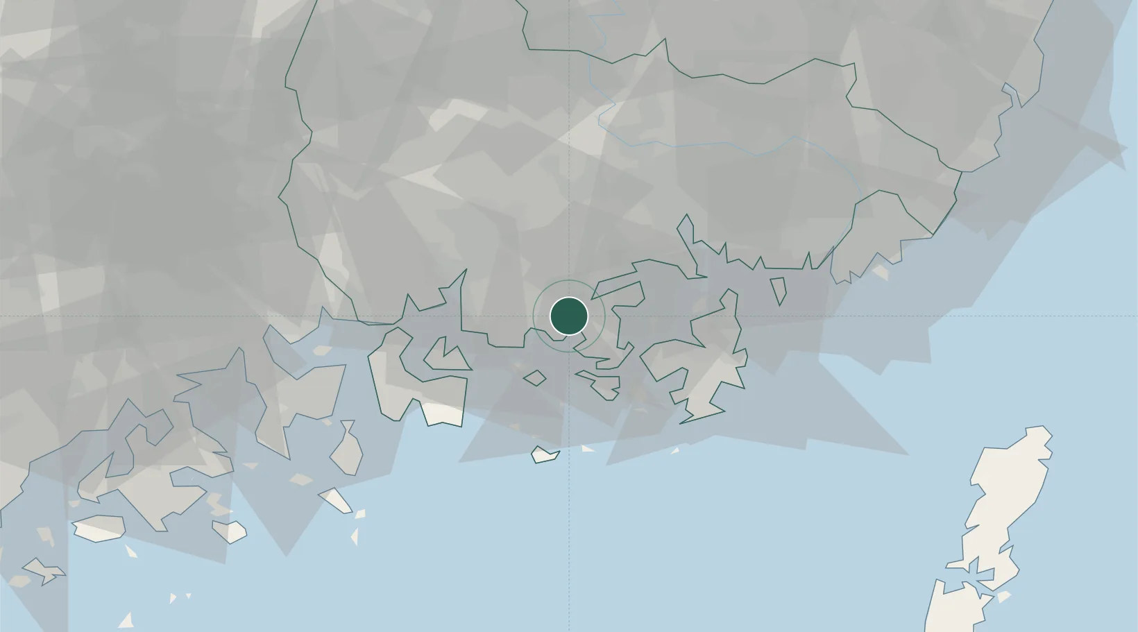
Nearby Logistics Neighbours

Cities
  1. 1Anjeong11 km
  2. 2Tongyeong17 km
  3. 3Junghwa21 km
  4. 4Samcheonpo/Sacheon24 km
  5. 5Geoje28 km
Nearest neighbours — logibook spatial index (haversine) over the source coordinates
Ports
  1. 1Masan33 km
  2. 2Chinae36 km
  3. 3Gwangyang Hang52 km
  4. 4Busan67 km
  5. 5Ulsan112 km
Nearest neighbours — logibook spatial index (haversine) over the source coordinates
Airports
  1. 1Sacheon Airport / Sacheon Air Base26 km
  2. 2Gimhae International Airport61 km
  3. 3Yeosu Airport65 km
  4. 4Daegu International Airport108 km
  5. 5Ulsan Airport117 km
Nearest neighbours — logibook spatial index (haversine) over the source coordinates
Trade Zones
  1. 1Sacheon Foreign Investment Zone26 km
  2. 2Sacheon 2 General Industrial Complex26 km
  3. 3Sangpyeong General Industrial Complex29 km
  4. 4Jinju Enterprise City31 km
  5. 5Masan Free Trade Zone38 km
Nearest neighbours — logibook spatial index (haversine) over the source coordinates
DatabookThe Record of Consolidated Knowledge
South Korea beyond logistics?
Browse databook

All Sources

LocationsUN/LOCODE
UN/LOCODE — free
Portsthe NGA World Port Index
Public domain (US gov)
AirportsOurAirports
Public domain
Trade Zonesthe World Bank SEZ database
CC BY 4.0
Trade ZonesOpen Zone Map
CC BY
← South Korea locations