UN/LOCODE hub · United Kingdom
GBTHT

South Uist and Eriskay

57.0667°, -7.2667°
1
Transport functions

Transport Functions

Port
UN/LOCODE

Hub Profile

Region
ELS
GeoNames

Location

Location of GBTHT
Natural Earth 10m (public domain) · ELS · GBTHT · 57.07, -7.27GoogleOSMYandex

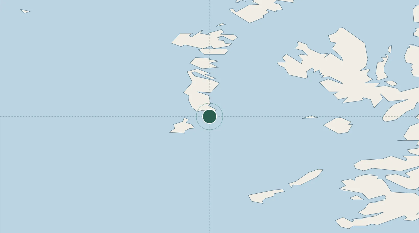
Nearby Logistics Neighbours

Cities
  1. 1Ceann a Gharaidh, Eriskay1 km
  2. 2Lochboisdale (Loch Baghasdail), South Uist10 km
  3. 3Aird Mhor (Ardmhor)11 km
  4. 4Ardveenish11 km
  5. 5Northbay11 km
Nearest neighbours — logibook spatial index (haversine) over the source coordinates
Ports
  1. 1Lochboisdale10 km
  2. 2Castle Bay18 km
  3. 3Lochmaddy60 km
  4. 4Portree Harbor75 km
  5. 5Uig80 km
Nearest neighbours — logibook spatial index (haversine) over the source coordinates
Airports
  1. 1Barra Airport12 km
  2. 2Benbecula Airport46 km
  3. 3Coll Airport65 km
  4. 4Tiree Airport68 km
  5. 5Colonsay Airstrip129 km
Nearest neighbours — logibook spatial index (haversine) over the source coordinates
Trade Zones
  1. 1Prestwick Airport Free Zone238 km
  2. 2Carlisle Kingmoor Park Enterprise Zone357 km
  3. 3Isle of Man Free Zone and Business Park370 km
  4. 4Dublin International Financial Services Centre418 km
  5. 5Blackpool Enterprise Zone453 km
Nearest neighbours — logibook spatial index (haversine) over the source coordinates
DatabookThe Record of Consolidated Knowledge
United Kingdom beyond logistics?
Browse databook

All Sources

LocationsUN/LOCODE
UN/LOCODE — free
Portsthe NGA World Port Index
Public domain (US gov)
AirportsOurAirports
Public domain
Trade Zonesthe World Bank SEZ database
CC BY 4.0
Trade ZonesOpen Zone Map
CC BY
← United Kingdom locations