UN/LOCODE hub · United Kingdom
GBKOH

Kinloch, Rum

57.0000°, -6.2833°
2
Transport functions

Transport Functions

Port
Road
UN/LOCODE

Hub Profile

Region
HLD
GeoNames

Location

Location of GBKOH
Natural Earth 10m (public domain) · HLD · GBKOH · 57.00, -6.28GoogleOSMYandex

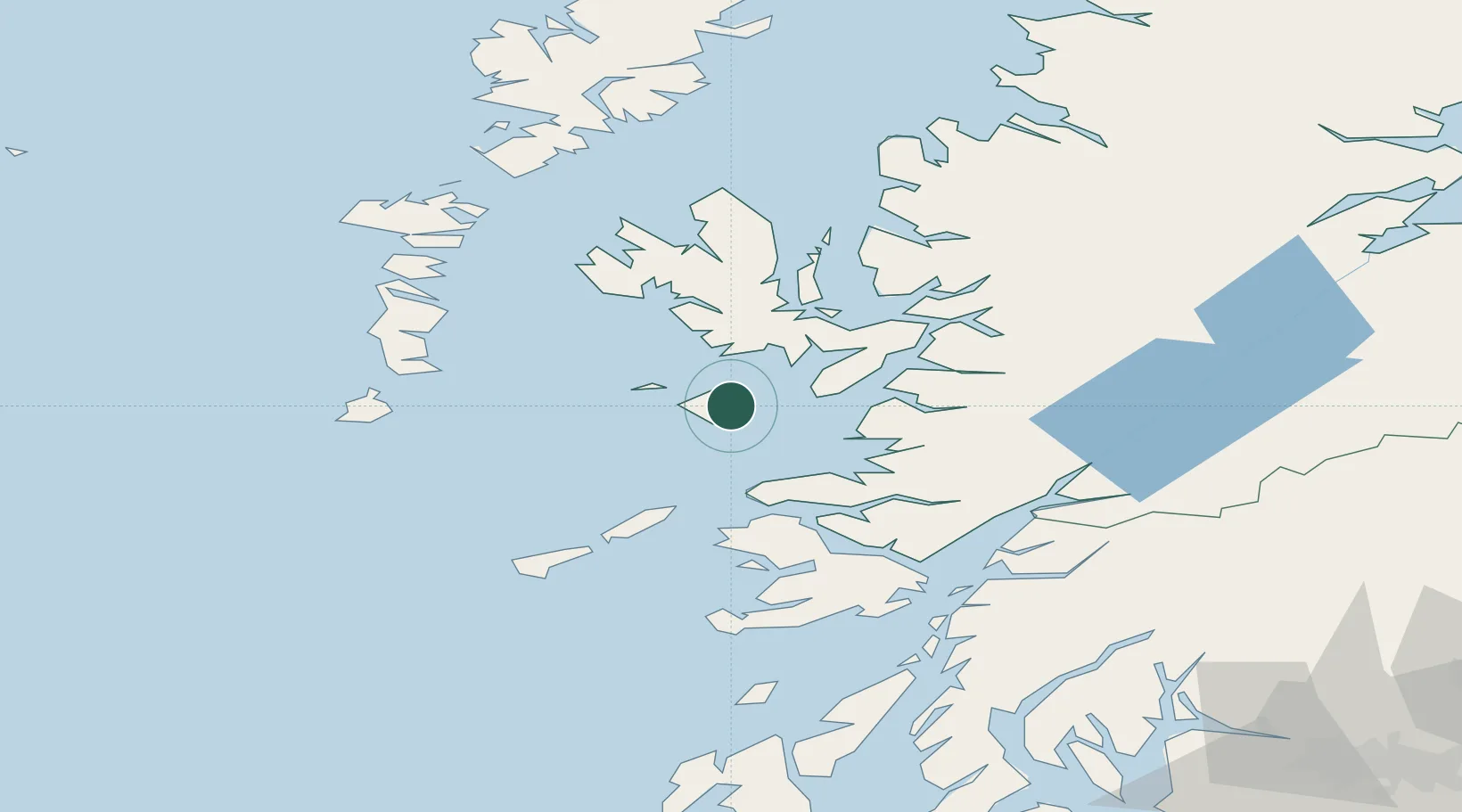
Nearby Logistics Neighbours

Cities
  1. 1Eigg13 km
  2. 2Canna, Inner Hebrides14 km
  3. 3Galmisdale, Eigg16 km
  4. 4Port Mor, Muck19 km
  5. 5Elgol, Isle of Skye20 km
Nearest neighbours — logibook spatial index (haversine) over the source coordinates
Ports
  1. 1Mallaig28 km
  2. 2Broadford Bay37 km
  3. 3Kyleakin45 km
  4. 4Tobermory45 km
  5. 5Kyle Of Lochalsh47 km
Nearest neighbours — logibook spatial index (haversine) over the source coordinates
Airports
  1. 1Coll Airport49 km
  2. 2Tiree Airport66 km
  3. 3Barra Airport70 km
  4. 4Oban Airport80 km
  5. 5Benbecula Airport84 km
Nearest neighbours — logibook spatial index (haversine) over the source coordinates
Trade Zones
  1. 1Prestwick Airport Free Zone195 km
  2. 2Carlisle Kingmoor Park Enterprise Zone309 km
  3. 3Isle of Man Free Zone and Business Park340 km
  4. 4Dublin International Financial Services Centre406 km
  5. 5Blackpool Enterprise Zone413 km
Nearest neighbours — logibook spatial index (haversine) over the source coordinates
DatabookThe Record of Consolidated Knowledge
United Kingdom beyond logistics?
Browse databook

All Sources

LocationsUN/LOCODE
UN/LOCODE — free
Portsthe NGA World Port Index
Public domain (US gov)
AirportsOurAirports
Public domain
Trade Zonesthe World Bank SEZ database
CC BY 4.0
Trade ZonesOpen Zone Map
CC BY
← United Kingdom locations