UN/LOCODE hub · United Kingdom
GBIGG

Eigg

56.9000°, -6.1667°
1
Transport functions

Transport Functions

Port
UN/LOCODE

Hub Profile

Region
HLD
GeoNames

Location

Location of GBIGG
Natural Earth 10m (public domain) · HLD · GBIGG · 56.90, -6.17GoogleOSMYandex

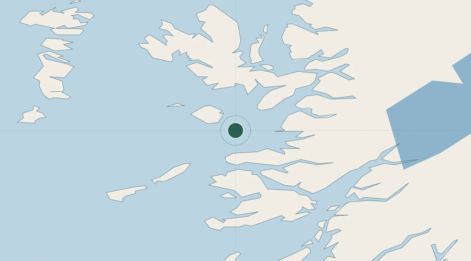
Nearby Logistics Neighbours

Cities
  1. 1Galmisdale, Eigg3 km
  2. 2Port Mor, Muck8 km
  3. 3Kinloch, Rum13 km
  4. 4Arisaig19 km
  5. 5Glenuig23 km
Nearest neighbours — logibook spatial index (haversine) over the source coordinates
Ports
  1. 1Mallaig24 km
  2. 2Tobermory32 km
  3. 3Broadford Bay43 km
  4. 4Lochaline46 km
  5. 5Kyleakin49 km
Nearest neighbours — logibook spatial index (haversine) over the source coordinates
Airports
  1. 1Coll Airport43 km
  2. 2Tiree Airport62 km
  3. 3Oban Airport68 km
  4. 4Barra Airport79 km
  5. 5Colonsay Airstrip94 km
Nearest neighbours — logibook spatial index (haversine) over the source coordinates
Trade Zones
  1. 1Prestwick Airport Free Zone182 km
  2. 2Carlisle Kingmoor Park Enterprise Zone296 km
  3. 3Isle of Man Free Zone and Business Park327 km
  4. 4Dublin International Financial Services Centre395 km
  5. 5Blackpool Enterprise Zone400 km
Nearest neighbours — logibook spatial index (haversine) over the source coordinates
DatabookThe Record of Consolidated Knowledge
United Kingdom beyond logistics?
Browse databook

All Sources

LocationsUN/LOCODE
UN/LOCODE — free
Portsthe NGA World Port Index
Public domain (US gov)
AirportsOurAirports
Public domain
Trade Zonesthe World Bank SEZ database
CC BY 4.0
Trade ZonesOpen Zone Map
CC BY
← United Kingdom locations