UN/LOCODE hub · France
FRZAH

Locoal-Mendon

47.7167°, -3.1000°
2,322
Population
1
Transport functions

Transport Functions

Multimodal
UN/LOCODE

Hub Profile

Place type
Populated place
GeoNames
Region
Brittany
GeoNames
Population
2,322
GeoNames
Time zone
Europe/Paris
GeoNames
Elevation
26 m
GeoNames

Location

Location of FRZAH
Natural Earth 10m (public domain) · Brittany · FRZAH · 47.72, -3.10GoogleOSMYandex

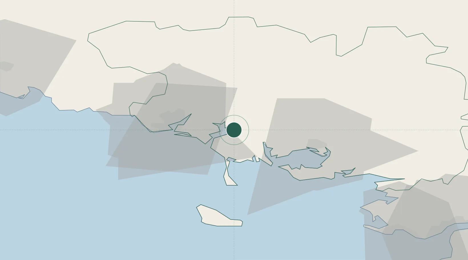
Nearby Logistics Neighbours

Cities
  1. 1Sainte-Hélène8 km
  2. 2Pluvigner9 km
  3. 3Auray10 km
  4. 4Etel11 km
  5. 5Crach13 km
Nearest neighbours — logibook spatial index (haversine) over the source coordinates
Ports
  1. 1Lorient19 km
  2. 2Concarneau63 km
  3. 3St Nazaire83 km
  4. 4Montoir86 km
  5. 5Donges90 km
Nearest neighbours — logibook spatial index (haversine) over the source coordinates
Airports
  1. 1Lorient South Brittany (Bretagne Sud) Airport26 km
  2. 2Vannes-Meucon Airport29 km
  3. 3Aérodrome de Belle Île44 km
  4. 4La Baule-Escoublac Airport74 km
  5. 5Saint-Nazaire-Montoir Airport84 km
Nearest neighbours — logibook spatial index (haversine) over the source coordinates
Trade Zones
  1. 1ZFU Saint-Nazaire79 km
  2. 2ZFU Nantes et Saint-Herblain119 km
  3. 3ZFU Angers189 km
  4. 4ZFU La Rochelle225 km
  5. 5ZFU Cherbourg-Octeville238 km
Nearest neighbours — logibook spatial index (haversine) over the source coordinates
DatabookThe Record of Consolidated Knowledge
France beyond logistics?
Browse databook

All Sources

LocationsUN/LOCODE
UN/LOCODE — free
LocationsGeoNames
CC BY 4.0
Portsthe NGA World Port Index
Public domain (US gov)
AirportsOurAirports
Public domain
Trade Zonesthe World Bank SEZ database
CC BY 4.0
Trade ZonesOpen Zone Map
CC BY
← France locations