UN/LOCODE hub · Finland
FIUKP

Nykarleby (Uusikaarlepyy)

63.5333°, 22.5333°
1
Transport functions

Transport Functions

Port
Nykarleby (Uusikaarlepyy) is also a profiled seaport →
UN/LOCODE

Hub Profile

Region
12
GeoNames

Location

Location of FIUKP
Natural Earth 10m (public domain) · 12 · FIUKP · 63.53, 22.53GoogleOSMYandex

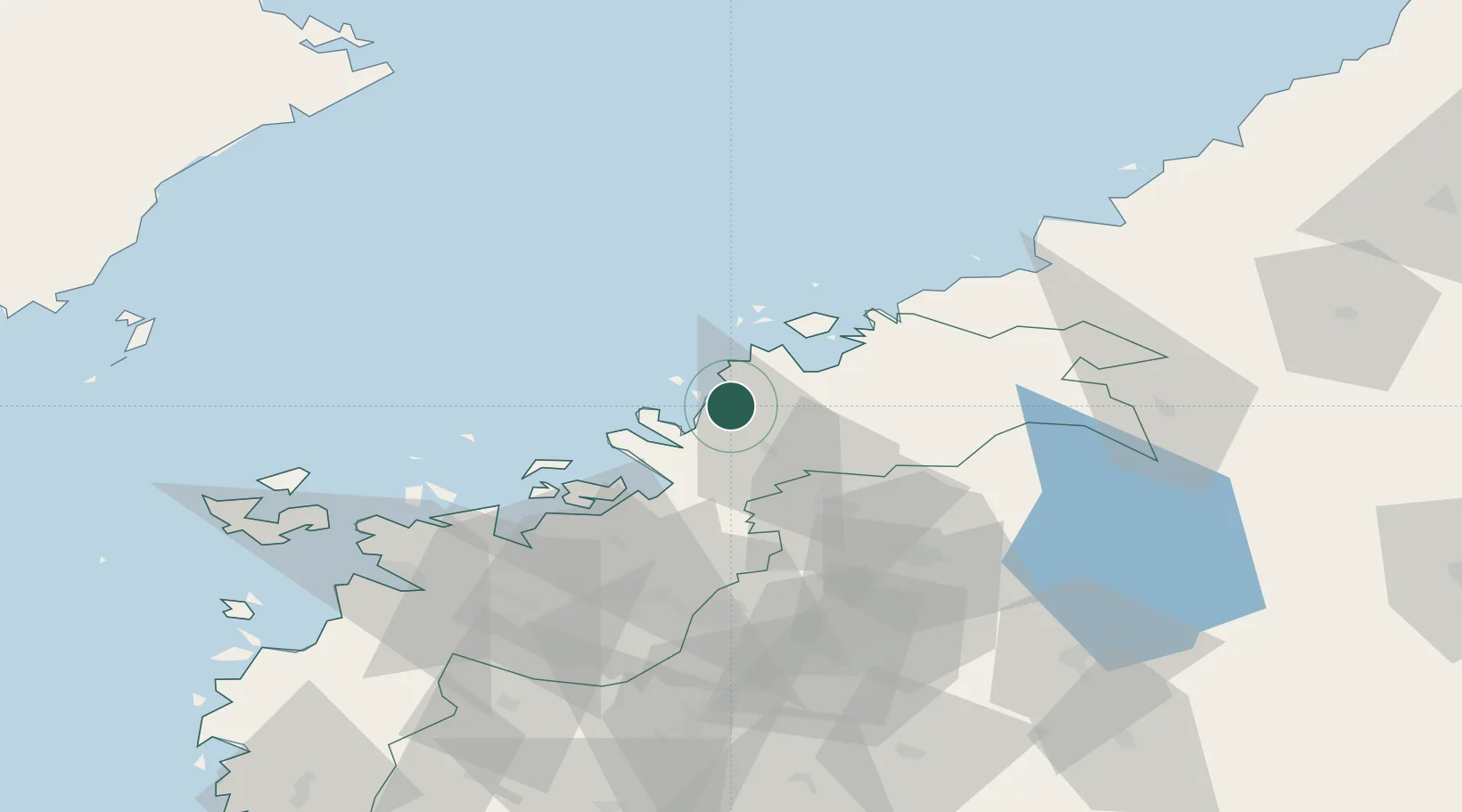
Nearby Logistics Neighbours

Cities
  1. 1Munsala11 km
  2. 2Pännäinen15 km
  3. 3Kållby (Kolppi)19 km
  4. 4Alholmen20 km
  5. 5Jakobstad (Pietarsaari)21 km
Nearest neighbours — logibook spatial index (haversine) over the source coordinates
Ports
  1. 1Pietarsaari18 km
  2. 2Kantlax18 km
  3. 3Hellnas32 km
  4. 4Kokkola43 km
  5. 5Vaasa68 km
Nearest neighbours — logibook spatial index (haversine) over the source coordinates
Airports
  1. 1Kokkola-Pietarsaari Airport37 km
  2. 2Kauhava Airfield52 km
  3. 3Vaasa Airport66 km
  4. 4Seinäjoki Airport95 km
  5. 5Umeå Airport115 km
Nearest neighbours — logibook spatial index (haversine) over the source coordinates
Trade Zones
  1. 1Oulu Port Free Warehouse Area214 km
  2. 2Turku Free Zone344 km
  3. 3Free Zone of Lappeenranta400 km
  4. 4Port of Hamina-Kotka411 km
  5. 5Freeport of Hanko412 km
Nearest neighbours — logibook spatial index (haversine) over the source coordinates
DatabookThe Record of Consolidated Knowledge
Finland beyond logistics?
Browse databook

All Sources

LocationsUN/LOCODE
UN/LOCODE — free
Portsthe NGA World Port Index
Public domain (US gov)
AirportsOurAirports
Public domain
Trade Zonesthe World Bank SEZ database
CC BY 4.0
Trade ZonesOpen Zone Map
CC BY
← Finland locations