UN/LOCODE hub · Finland
FIMUN

Munsala

63.4833°, 22.3333°
1
Transport functions

Transport Functions

Port
UN/LOCODE

Hub Profile

Place type
Populated place
GeoNames
Region
Ostrobothnia
GeoNames
Time zone
Europe/Helsinki
GeoNames
Elevation
22 m
GeoNames

Location

Location of FIMUN
Natural Earth 10m (public domain) · Ostrobothnia · FIMUN · 63.48, 22.33GoogleOSMYandex

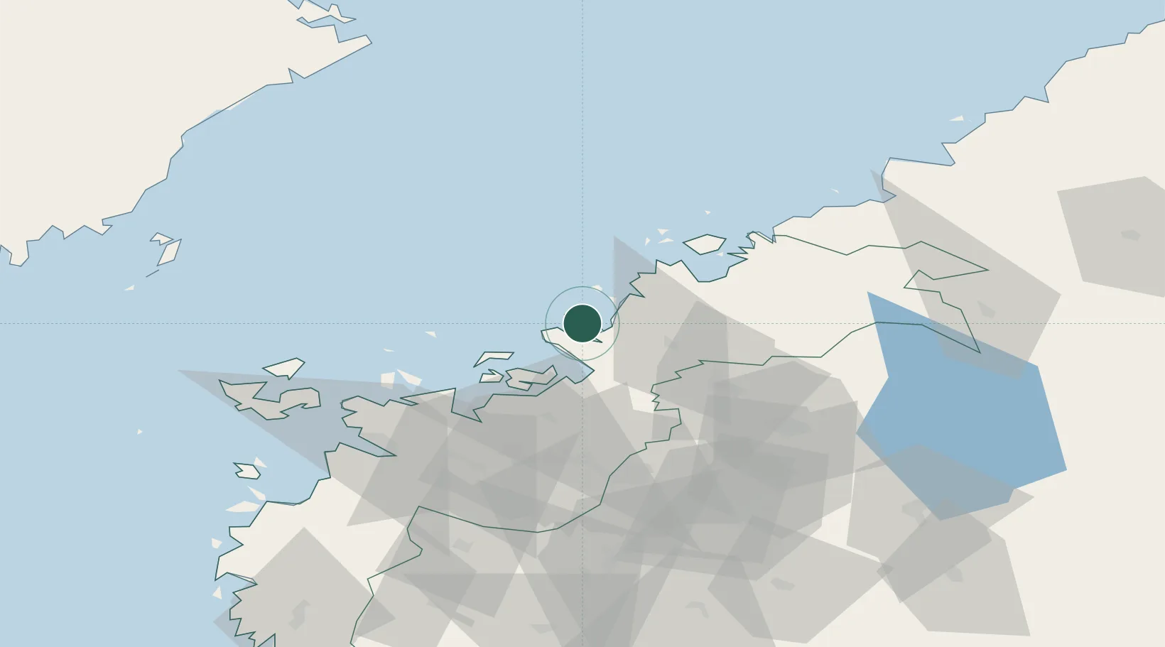
Nearby Logistics Neighbours

Cities
  1. 1Nykarleby (Uusikaarlepyy)11 km
  2. 2Pännäinen27 km
  3. 3Alholmen30 km
  4. 4Kållby (Kolppi)30 km
  5. 5Tottesund31 km
Nearest neighbours — logibook spatial index (haversine) over the source coordinates
Ports
  1. 1Kantlax8 km
  2. 2Nykarleby11 km
  3. 3Hellnas23 km
  4. 4Pietarsaari28 km
  5. 5Kokkola53 km
Nearest neighbours — logibook spatial index (haversine) over the source coordinates
Airports
  1. 1Kokkola-Pietarsaari Airport48 km
  2. 2Kauhava Airfield53 km
  3. 3Vaasa Airport56 km
  4. 4Seinäjoki Airport92 km
  5. 5Umeå Airport107 km
Nearest neighbours — logibook spatial index (haversine) over the source coordinates
Trade Zones
  1. 1Oulu Port Free Warehouse Area225 km
  2. 2Turku Free Zone338 km
  3. 3Free Zone of Lappeenranta404 km
  4. 4Freeport of Hanko407 km
  5. 5Port of Hamina-Kotka412 km
Nearest neighbours — logibook spatial index (haversine) over the source coordinates
DatabookThe Record of Consolidated Knowledge
Finland beyond logistics?
Browse databook

All Sources

LocationsUN/LOCODE
UN/LOCODE — free
Portsthe NGA World Port Index
Public domain (US gov)
AirportsOurAirports
Public domain
Trade Zonesthe World Bank SEZ database
CC BY 4.0
Trade ZonesOpen Zone Map
CC BY
← Finland locations