UN/LOCODE hub · Ecuador
ECMEC

Manta

-0.9410°, -80.7277°
264,281
Population
2
Transport functions

Transport Functions

Port
Airport
Manta is also a profiled seaport →
UN/LOCODE

Hub Profile

Place type
Provincial seat
GeoNames
Region
Manabí
GeoNames
Population
264,281
GeoNames
Time zone
America/Guayaquil
GeoNames
Elevation
3 m
GeoNames
Logistics facilities
1
UN/LOCODE

Location

Location of ECMEC
Natural Earth 10m (public domain) · Manabí · ECMEC · -0.94, -80.73GoogleOSMYandex

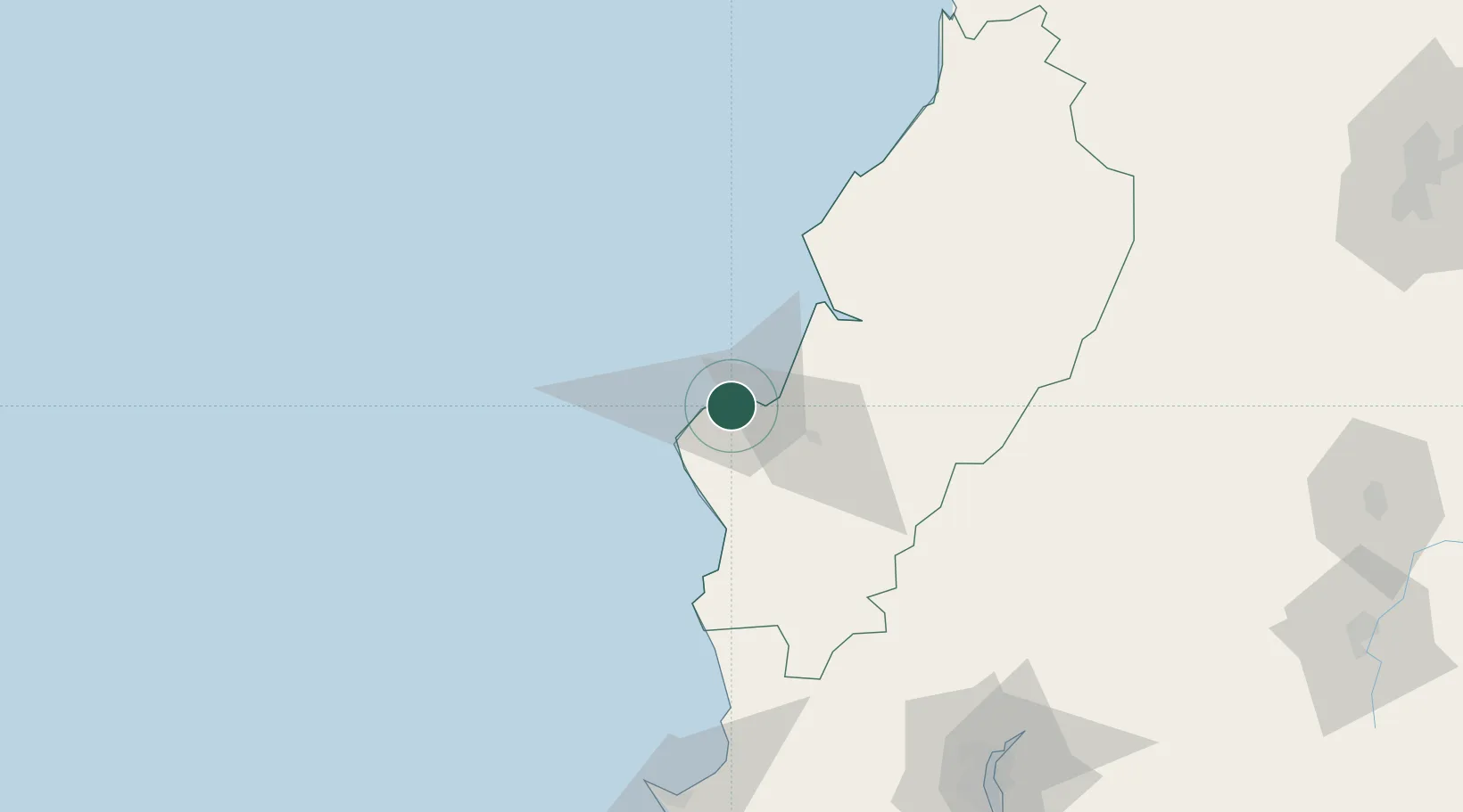
Nearby Logistics Neighbours

Cities
  1. 1Montecristi14 km
  2. 2Jipijapa47 km
  3. 3Bahía de Caráquez50 km
  4. 4Chone75 km
  5. 5Velasco Ibarra124 km
Nearest neighbours — logibook spatial index (haversine) over the source coordinates
Ports
  1. 1La Libertad143 km
  2. 2Guayaquil169 km
  3. 3Puerto Maritimo De Guayaquil175 km
  4. 4Esmeraldas247 km
  5. 5Puerto Bolivar271 km
Nearest neighbours — logibook spatial index (haversine) over the source coordinates
Airports
  1. 1Eloy Alfaro International Airport6 km
  2. 2Reales Tamarindos Airport31 km
  3. 3General Ulpiano Paez International Airport144 km
  4. 4José Joaquín de Olmedo International Airport165 km
  5. 5Cotopaxi International Airport235 km
Nearest neighbours — logibook spatial index (haversine) over the source coordinates
Trade Zones
  1. 1Zona Franca de Manta3 km
  2. 2Zona Franca Manabí7 km
  3. 3Zona Franca Esmeraldas163 km
  4. 4Contecon Guayaquil Free Zone175 km
  5. 5DP World Posorja202 km
Nearest neighbours — logibook spatial index (haversine) over the source coordinates
DatabookThe Record of Consolidated Knowledge
Ecuador beyond logistics?
Browse databook

All Sources

LocationsUN/LOCODE
UN/LOCODE — free
LocationsGeoNames
CC BY 4.0
Portsthe NGA World Port Index
Public domain (US gov)
AirportsOurAirports
Public domain
Trade Zonesthe World Bank SEZ database
CC BY 4.0
Trade ZonesOpen Zone Map
CC BY
← Ecuador locations