UN/LOCODE hub · Germany
DENZN

Notzingen

48.6667°, 9.4500°
3,475
Population
1
Transport functions

Transport Functions

Multimodal
UN/LOCODE

Hub Profile

Place type
Local administrative seat
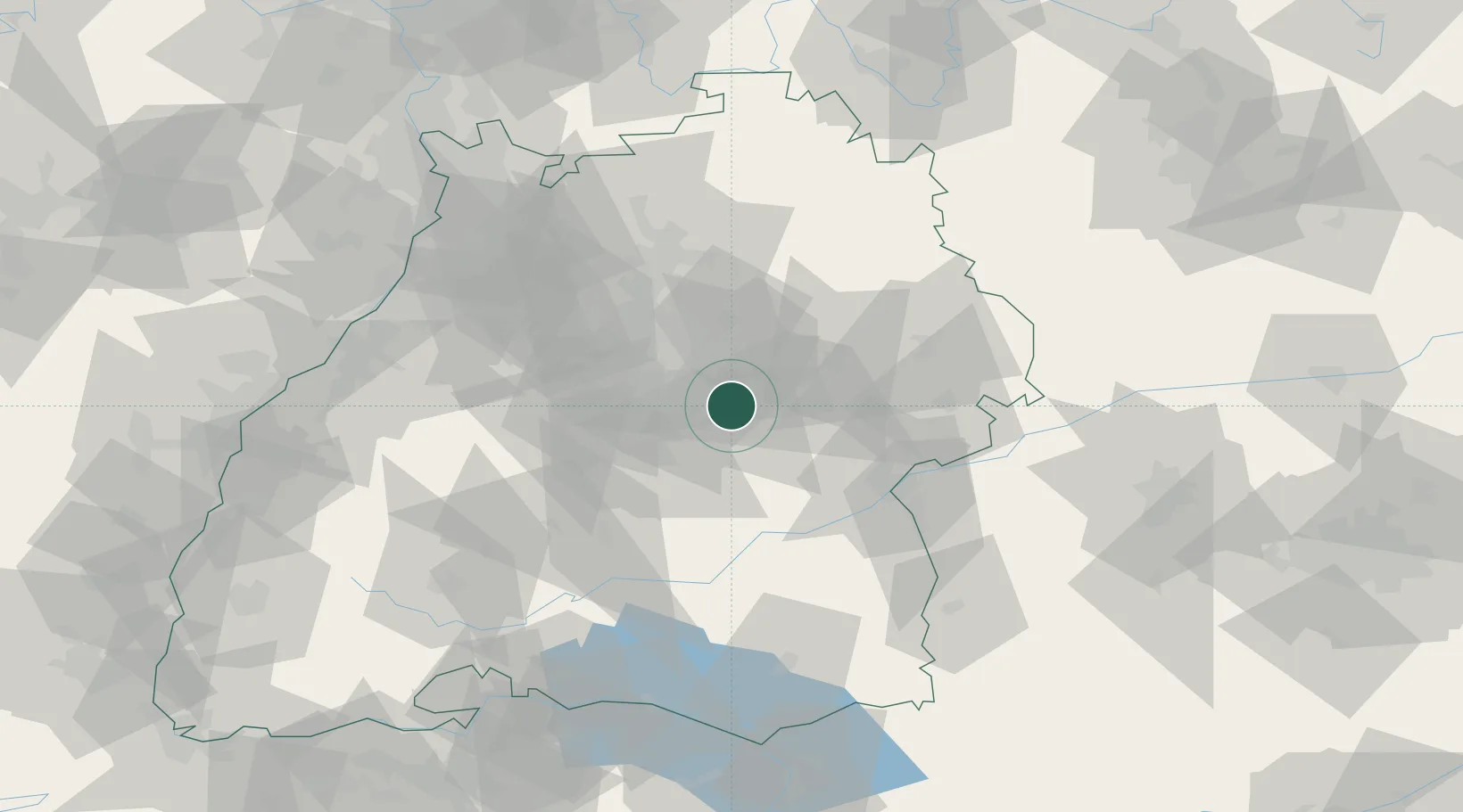
GeoNames
Region
Baden-Wurttemberg
GeoNames
Population
3,475
GeoNames
Time zone
Europe/Berlin
GeoNames
Elevation
314 m
GeoNames

Location

Location of DENZN
Natural Earth 10m (public domain) · Baden-Wurttemberg · DENZN · 48.67, 9.45GoogleOSMYandex

Nearby Logistics Neighbours

Cities
  1. 1Wendlingen am Neckar5 km
  2. 2Reichenbach an der Fils6 km
  3. 3Oberboihingen6 km
  4. 4Baltmannsweiler7 km
  5. 5Ebersbach an der Fils8 km
Nearest neighbours — logibook spatial index (haversine) over the source coordinates
Ports
  1. 1Porto Di Lido-Venezia426 km
  2. 2Nogaro428 km
  3. 3Porto Di Chioggia439 km
  4. 4Grado440 km
  5. 5Bruxelles440 km
Nearest neighbours — logibook spatial index (haversine) over the source coordinates
Airports
  1. 1Stuttgart Airport17 km
  2. 2Adolf Würth Airport56 km
  3. 3Laupheim Air Base60 km
  4. 4Mengen-Hohentengen Airfield68 km
  5. 5Niederstetten Army Air Base89 km
Nearest neighbours — logibook spatial index (haversine) over the source coordinates
Trade Zones
  1. 1ZFU Neuhof125 km
  2. 2ZFU Hautepierre129 km
  3. 3ZFU Mulhouse187 km
  4. 4ZFU La Cité Behren-lès-Forbach193 km
  5. 5ZFU Belfort227 km
Nearest neighbours — logibook spatial index (haversine) over the source coordinates
DatabookThe Record of Consolidated Knowledge
Germany beyond logistics?
Browse databook

All Sources

LocationsUN/LOCODE
UN/LOCODE — free
LocationsGeoNames
CC BY 4.0
Portsthe NGA World Port Index
Public domain (US gov)
AirportsOurAirports
Public domain
Trade Zonesthe World Bank SEZ database
CC BY 4.0
Trade ZonesOpen Zone Map
CC BY
← Germany locations