UN/LOCODE hub · Costa Rica
CRPLL

Laurel

8.4333°, -82.9500°
1
Transport functions

Transport Functions

Multimodal
UN/LOCODE

Hub Profile

Place type
Populated place
GeoNames
Region
Puntarenas Province
GeoNames
Time zone
America/Costa_Rica
GeoNames
Elevation
21 m
GeoNames

Location

Location of CRPLL
Natural Earth 10m (public domain) · Puntarenas Province · CRPLL · 8.43, -82.95GoogleOSMYandex

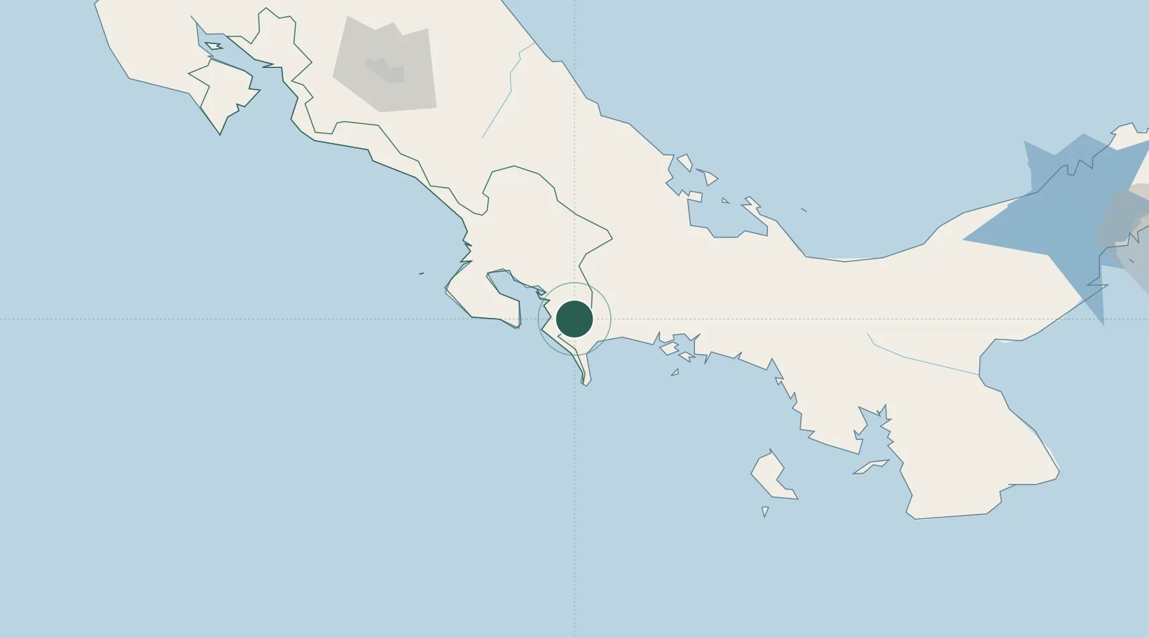
Nearby Logistics Neighbours

Cities
  1. 1Progreso13 km
  2. 2Neily24 km
  3. 3Golfito33 km
  4. 4Bugaba37 km
  5. 5Pedregal57 km
Nearest neighbours — logibook spatial index (haversine) over the source coordinates
Ports
  1. 1Puerto Armuelles22 km
  2. 2Charco Azul26 km
  3. 3Golfito33 km
  4. 4Pedregal58 km
  5. 5Chiriqui Grande108 km
Nearest neighbours — logibook spatial index (haversine) over the source coordinates
Airports
  1. 1Coto 47 Airport19 km
  2. 2Golfito Airport35 km
  3. 3Puerto Jimenez Airport40 km
  4. 4Enrique Malek International Airport57 km
  5. 5Palmar Sur Airport81 km
Nearest neighbours — logibook spatial index (haversine) over the source coordinates
Trade Zones
  1. 1Baru Free Zone (Tourist and Multimodal Logistics Support Zone)21 km
  2. 2Caribe Industrial Park & Free Zone174 km
  3. 3Zeta Free Zone Catargo193 km
  4. 4Lima Free Zone and Business Park194 km
  5. 5FreeHold Free Zone194 km
Nearest neighbours — logibook spatial index (haversine) over the source coordinates
DatabookThe Record of Consolidated Knowledge
Costa Rica beyond logistics?
Browse databook

All Sources

LocationsUN/LOCODE
UN/LOCODE — free
Portsthe NGA World Port Index
Public domain (US gov)
AirportsOurAirports
Public domain
Trade Zonesthe World Bank SEZ database
CC BY 4.0
Trade ZonesOpen Zone Map
CC BY
← Costa Rica locations