UN/LOCODE hub · Canada
CAALF

Alfred

45.5500°, -74.8667°
1
Transport functions

Transport Functions

Rail
UN/LOCODE

Hub Profile

Place type
Populated place
GeoNames
Region
Ontario
GeoNames
Time zone
America/Toronto
GeoNames
Elevation
68 m
GeoNames

Location

Location of CAALF
Natural Earth 10m (public domain) · Ontario · CAALF · 45.55, -74.87GoogleOSMYandex

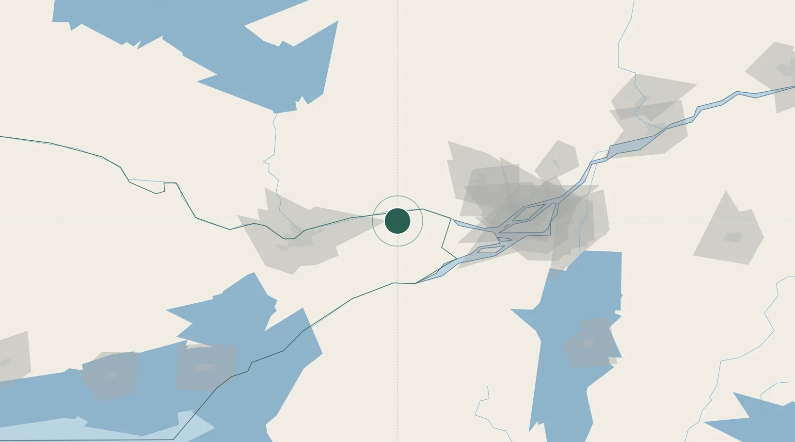
Nearby Logistics Neighbours

Cities
  1. 1Plantagenet11 km
  2. 2Montebello12 km
  3. 3Saint-André-Avellin23 km
  4. 4Moose Creek34 km
  5. 5Monkland39 km
Nearest neighbours — logibook spatial index (haversine) over the source coordinates
Ports
  1. 1Fassett11 km
  2. 2Montebello12 km
  3. 3Papineauville14 km
  4. 4Hawkesbury21 km
  5. 5Grenville23 km
Nearest neighbours — logibook spatial index (haversine) over the source coordinates
Airports
  1. 1Ottawa / Gatineau Airport54 km
  2. 2Cornwall Regional Airport56 km
  3. 3Ottawa / Rockcliffe Airport61 km
  4. 4Montreal Mirabel International Airport66 km
  5. 5Ottawa Macdonald-Cartier International Airport68 km
Nearest neighbours — logibook spatial index (haversine) over the source coordinates
Trade Zones
  1. 1Greater Montreal Free Zone Center102 km
  2. 2FTZ No. 118 Ogdensburg106 km
  3. 3FTZ No. 109 Watertown192 km
  4. 4FTZ No. 090 Onondaga269 km
  5. 5FTZ No. 172 Oneida County273 km
Nearest neighbours — logibook spatial index (haversine) over the source coordinates
DatabookThe Record of Consolidated Knowledge
Canada beyond logistics?
Browse databook

All Sources

LocationsUN/LOCODE
UN/LOCODE — free
Portsthe NGA World Port Index
Public domain (US gov)
AirportsOurAirports
Public domain
Trade Zonesthe World Bank SEZ database
CC BY 4.0
Trade ZonesOpen Zone Map
CC BY
← Canada locations