UN/LOCODE hub · Argentina
ARPLR

Pilar

-34.4333°, -58.9000°
81,120
Population
2
Transport functions

Transport Functions

Rail
Road
UN/LOCODE

Hub Profile

Place type
Provincial seat
GeoNames
Region
Buenos Aires
GeoNames
Population
81,120
GeoNames
Time zone
America/Argentina/Buenos_Aires
GeoNames
Elevation
27 m
GeoNames

Location

Location of ARPLR
Natural Earth 10m (public domain) · Buenos Aires · ARPLR · -34.43, -58.90GoogleOSMYandex

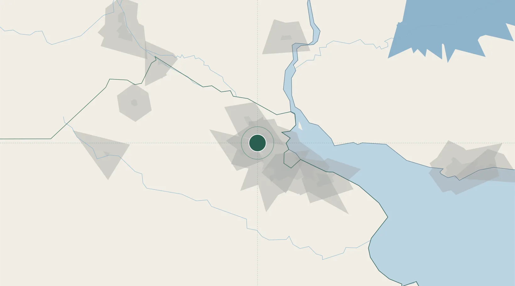
Nearby Logistics Neighbours

Cities
  1. 1Belén de Escobar14 km
  2. 2José C. Paz16 km
  3. 3Luján24 km
  4. 4Capilla del Señor24 km
  5. 5Tigre29 km
Nearest neighbours — logibook spatial index (haversine) over the source coordinates
Ports
  1. 1Campana32 km
  2. 2Zarate41 km
  3. 3Buenos Aires52 km
  4. 4Nueva Palmira76 km
  5. 5Puerto Ibicuy80 km
Nearest neighbours — logibook spatial index (haversine) over the source coordinates
Airports
  1. 1San Fernando Airport29 km
  2. 2El Palomar Airport33 km
  3. 3Aeroparque Jorge Newbery47 km
  4. 4Ezeiza International Airport - Ministro Pistarini55 km
  5. 5La Plata Airport110 km
Nearest neighbours — logibook spatial index (haversine) over the source coordinates
Trade Zones
  1. 1Zona Sur Buenos Aires43 km
  2. 2Nueva Palmira Free Zone75 km
  3. 3Montes de Plata Free Zone81 km
  4. 4Colonia Free Zone98 km
  5. 5La Plata Free Trade Zone102 km
Nearest neighbours — logibook spatial index (haversine) over the source coordinates
DatabookThe Record of Consolidated Knowledge
Argentina beyond logistics?
Browse databook

All Sources

LocationsUN/LOCODE
UN/LOCODE — free
LocationsGeoNames
CC BY 4.0
Portsthe NGA World Port Index
Public domain (US gov)
AirportsOurAirports
Public domain
Trade Zonesthe World Bank SEZ database
CC BY 4.0
Trade ZonesOpen Zone Map
CC BY
← Argentina locations