UN/LOCODE hub · Armenia
AMEVN

Yerevan

40.1360°, 44.4617°
1,144,700
Population
4
Transport functions

Transport Functions

Rail
Road
Airport
Postal
UN/LOCODE

Hub Profile

Place type
National capital
GeoNames
Region
Yerevan
GeoNames
Population
1,144,700
GeoNames
Time zone
Asia/Yerevan
GeoNames
Elevation
1,002 m
GeoNames
Logistics facilities
2
UN/LOCODE

Location

Location of AMEVN
Natural Earth 10m (public domain) · Yerevan · AMEVN · 40.14, 44.46GoogleOSMYandex

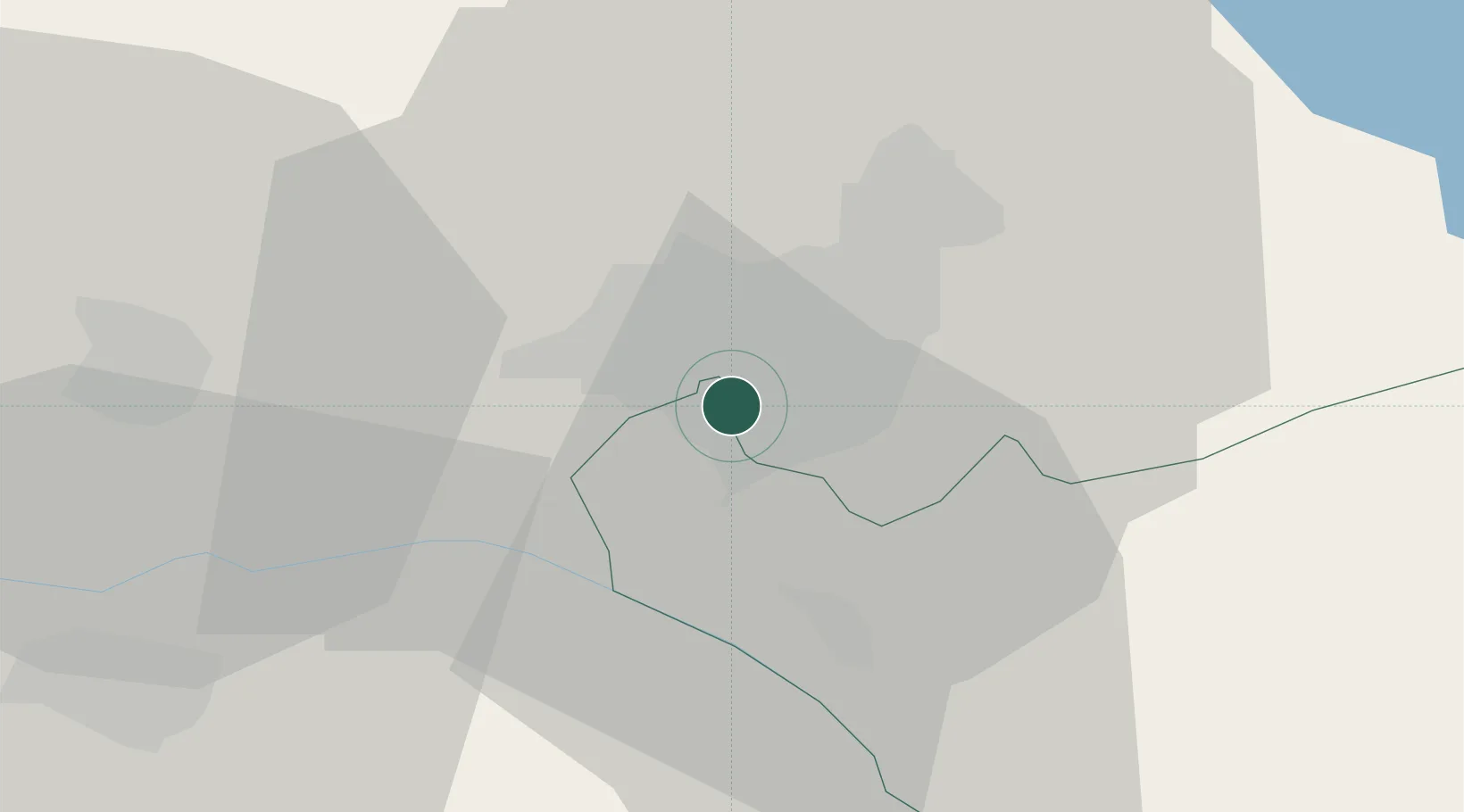
Nearby Logistics Neighbours

Cities
  1. 1Masis13 km
  2. 2Metsamor17 km
  3. 3Aragatsotn28 km
  4. 4Abovyan31 km
  5. 5Armavir38 km
Nearest neighbours — logibook spatial index (haversine) over the source coordinates
Ports
  1. 1Batumi290 km
  2. 2Hopa295 km
  3. 3Supsa Marine Terminal317 km
  4. 4Rize349 km
  5. 5Trabzon408 km
Nearest neighbours — logibook spatial index (haversine) over the source coordinates
Airports
  1. 1Erebuni Airport2 km
  2. 2Zvartnots International Airport6 km
  3. 3Iğdır Airport53 km
  4. 4Shirak International Airport85 km
  5. 5Maku National Airport112 km
Nearest neighbours — logibook spatial index (haversine) over the source coordinates
Trade Zones
  1. 1Meridian Free Economic Zone6 km
  2. 2Alliance Free Zone7 km
  3. 3Jrvezh Engineering City13 km
  4. 4Ecos Free Economic Zone52 km
  5. 5Maku Mako Trade-Industrial Free Zone86 km
Nearest neighbours — logibook spatial index (haversine) over the source coordinates
DatabookThe Record of Consolidated Knowledge
Armenia beyond logistics?
Browse databook

All Sources

LocationsUN/LOCODE
UN/LOCODE — free
LocationsGeoNames
CC BY 4.0
Portsthe NGA World Port Index
Public domain (US gov)
AirportsOurAirports
Public domain
Trade Zonesthe World Bank SEZ database
CC BY 4.0
Trade ZonesOpen Zone Map
CC BY
← Armenia locations