Small airport · Russia

Yuzhno-Kurilsk Mendeleyevo AirportUHSM

43.9611°, 145.6850°
584 ft
Elevation

Runway & Layout

Yuzhno-Kurilsk Mendeleyevo Airport runway & taxiway layout
Runway & taxiway layout — OpenStreetMap (ODbL) / OurAirports

Airport Specifications
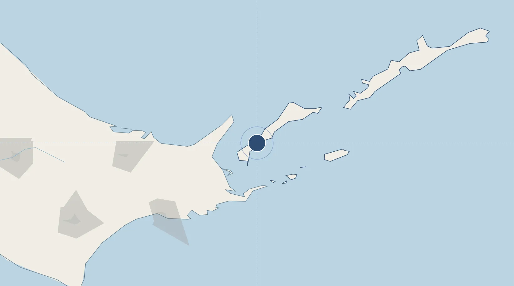
IATA code
DEE
OurAirports
ICAO code
UHSM
OurAirports
Airport class
Small airport
OurAirports
Scheduled service
Yes
OurAirports
Served city
Yuzhno-Kurilsk
OurAirports

Location

Location of UHSM
Natural Earth 10m (public domain) · Sakhalin · UHSM · 43.96, 145.68GoogleOSMYandex

Nearby Logistics Neighbours

Airports
  1. 1Nakashibetsu Airport72 km
  2. 2JASDF Kenebetsu Airfield97 km
  3. 3Memanbetsu Airport122 km
  4. 4Kushiro Airport158 km
  5. 5Monbetsu Airport186 km
Nearest neighbours — logibook spatial index (haversine) over the source coordinates
Cities
  1. 1Yuzhno-Kuril'sk16 km
  2. 2Shibetsu57 km
  3. 3Kushiro153 km
  4. 4Shiranuka171 km
  5. 5Kuril'skiy Burevestnik AFB (Burevestnik AFB)189 km
Nearest neighbours — logibook spatial index (haversine) over the source coordinates
Ports
  1. 1Nemuro Ko70 km
  2. 2Hanasaki Ko76 km
  3. 3Abashiri Ko112 km
  4. 4Kushiro Ko152 km
  5. 5Tokachi271 km
Nearest neighbours — logibook spatial index (haversine) over the source coordinates
DatabookThe Record of Consolidated Knowledge
Russia beyond logistics?
Browse databook

All Sources

AirportsOurAirports
Public domain
Portsthe NGA World Port Index
Public domain (US gov)
LocationsUN/LOCODE
UN/LOCODE — free
Trade Zonesthe World Bank SEZ database
CC BY 4.0
Trade ZonesOpen Zone Map
CC BY
InfrastructureOpenStreetMap
ODbL 1.0
← Russia airports