Large airport · Argentina

Piloto Civil Norberto Fernández International AirportSAWG
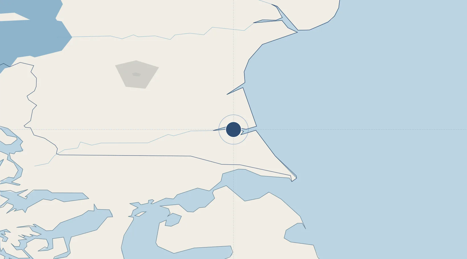
-51.6088°, -69.3089°
11,644 ft
Longest runway
1
Runways
61 ft
Elevation

Runway & Layout

Piloto Civil Norberto Fernández International Airport runway & taxiway layout
Runway & taxiway layout — OpenStreetMap (ODbL) / OurAirports

Radio Frequencies

ATIS
116.7 MHz
APP
119.1 MHz
APP/TWR
RDO
122.1 MHz
TCA
124.7 MHz
CON
OurAirports

Navaids

G NDB Rio Gallegos 255 kHz
GAL VOR-DME Rio Gallegos 116.70 MHz
GAL NDB Rio Gallegos 330 kHz
OurAirports

Runways · 1

RunwayDimensions SurfaceTrue headingLit
7/25 11,644 × 148ft Concrete 086°
OurAirports

Airport Specifications

IATA code
RGL
OurAirports
ICAO code
SAWG
OurAirports
Airport class
Large airport
OurAirports
Scheduled service
Yes
OurAirports
Runway surface
Concrete
OurAirports
Served city
Rio Gallegos
OurAirports

Location

Location of SAWG
Natural Earth 10m (public domain) · Santa Cruz · SAWG · -51.61, -69.31GoogleOSMYandex

Nearby Logistics Neighbours

Airports
  1. 1Santa Cruz Airport184 km
  2. 2President Carlos Ibáñez International Airport187 km
  3. 3Captain Fuentes Martinez Airport195 km
  4. 428 de Noviembre Airport201 km
  5. 5Lieutenant Julio Gallardo Airport222 km
Nearest neighbours — logibook spatial index (haversine) over the source coordinates
Cities
  1. 1Río Gallegos7 km
  2. 2Bahía San Gregorio125 km
  3. 3Caleta Clarencia152 km
  4. 4Rio Cullen153 km
  5. 5Puerto Percy158 km
Nearest neighbours — logibook spatial index (haversine) over the source coordinates
Ports
  1. 1Puerto Gallegos24 km
  2. 2Puerto Sara129 km
  3. 3Caleta Clarencia153 km
  4. 4San Sebastian Bay182 km
  5. 5Puerto Santa Cruz186 km
Nearest neighbours — logibook spatial index (haversine) over the source coordinates
DatabookThe Record of Consolidated Knowledge
Argentina beyond logistics?
Browse databook

All Sources

AirportsOurAirports
Public domain
Portsthe NGA World Port Index
Public domain (US gov)
LocationsUN/LOCODE
UN/LOCODE — free
Trade Zonesthe World Bank SEZ database
CC BY 4.0
Trade ZonesOpen Zone Map
CC BY
InfrastructureOpenStreetMap
ODbL 1.0
← Argentina airports