Free Trade Zone · Vietnam

Đông Nam Nghê An Coastal Economic Zone Active
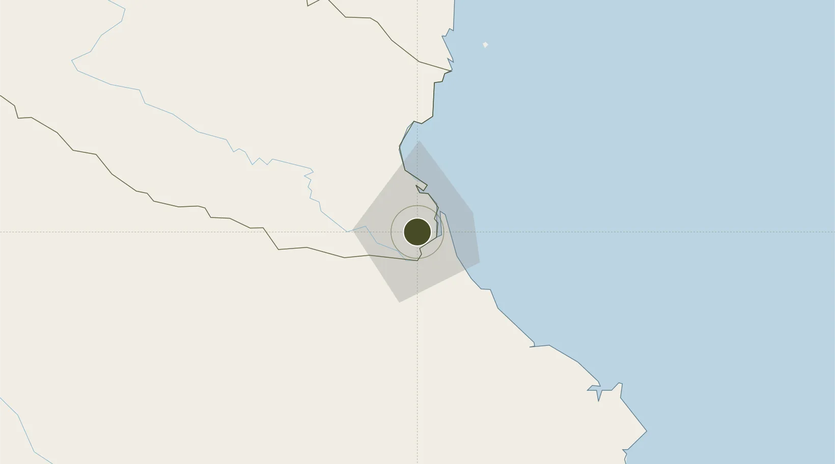
18.6825°, 105.6806°
20,776 ha
Zone area
13.0 km
Nearest port
6.2 km
Nearest airport

Gateway access

Nearest neighbours — logibook spatial index (haversine) over the source coordinates

Zone profile

Zone type
Free Trade Zone
Open Zone Map
Region
Nghệ An
Open Zone Map
Status
Active
Open Zone Map
Management
Public
Open Zone Map
Operator
Management Board of Dong Nam Nghe An Economic Zone
Open Zone Map
Legal framework
Decision No. 1353/QD-TTg dated September 23, 2008,
Open Zone Map

Location

Location of ozm-5179
Natural Earth 10m (public domain) · Nghệ An · ozm-5179 · 18.68, 105.68GoogleOSMYandex

Nearby Logistics Neighbours

Ports
  1. 1Nghe Tinh13 km
  2. 2Hai Phong270 km
  3. 3Hon Gai291 km
  4. 4Basuo312 km
  5. 5Cam Pha315 km
Nearest neighbours — logibook spatial index (haversine) over the source coordinates
Airports
  1. 1Vinh Airport6 km
  2. 2Tho Xuan Airport137 km
  3. 3Dong Hoi Airport162 km
  4. 4Nakhon Phanom Airport181 km
  5. 5Sakon Nakhon Airport234 km
Nearest neighbours — logibook spatial index (haversine) over the source coordinates
Cities
  1. 1Vinh6 km
  2. 2Culao13 km
  3. 3Cua Lo15 km
  4. 4Van Lâm17 km
  5. 5Rao Qua46 km
Nearest neighbours — logibook spatial index (haversine) over the source coordinates
Trade Zones
  1. 1Bac Vinh Industrial Park4 km
  2. 2Vsip Industrial Park - Nghe An5 km
  3. 3Wha Industrial Zone 1 - Nghe An15 km
  4. 4Nam Cam Industrial Park16 km
  5. 5Hoàng Mai Mai Industrial Zone66 km
Nearest neighbours — logibook spatial index (haversine) over the source coordinates
DatabookThe Record of Consolidated Knowledge
Vietnam beyond logistics?
Browse databook

All Sources

Trade ZonesOpen Zone Map
CC BY
Portsthe NGA World Port Index
Public domain (US gov)
AirportsOurAirports
Public domain
LocationsUN/LOCODE
UN/LOCODE — free
← Vietnam trade zones