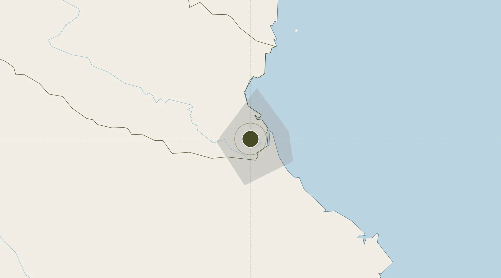
Diversified Zone · Vietnam

Bac Vinh Industrial Park Active

18.7070°, 105.6499°
60 ha
Zone area
14.0 km
Nearest port
4.1 km
Nearest airport

Gateway access

Nearest neighbours — logibook spatial index (haversine) over the source coordinates

Zone profile

Zone type
Diversified Zone
Open Zone Map
Region
Nghệ An
Open Zone Map
Status
Active
Open Zone Map
Management
Public-Private Partnership
Open Zone Map
Operator
WHA Indutrial Management Services Vietnam Company Limited
Open Zone Map
Legal framework
Decree No.82/2018/ND-CP on Management of Industrial Parks and Economic Zones, Decree No 218/2013/ND-CP
Open Zone Map

Location

Location of ozm-5027
Natural Earth 10m (public domain) · Nghệ An · ozm-5027 · 18.71, 105.65GoogleOSMYandex

Nearby Logistics Neighbours

Ports
  1. 1Nghe Tinh14 km
  2. 2Hai Phong268 km
  3. 3Hon Gai290 km
  4. 4Cam Pha315 km
  5. 5Basuo315 km
Nearest neighbours — logibook spatial index (haversine) over the source coordinates
Airports
  1. 1Vinh Airport4 km
  2. 2Tho Xuan Airport134 km
  3. 3Dong Hoi Airport166 km
  4. 4Nakhon Phanom Airport182 km
  5. 5Sakon Nakhon Airport233 km
Nearest neighbours — logibook spatial index (haversine) over the source coordinates
Cities
  1. 1Vinh3 km
  2. 2Culao12 km
  3. 3Cua Lo14 km
  4. 4Van Lâm14 km
  5. 5Rao Qua45 km
Nearest neighbours — logibook spatial index (haversine) over the source coordinates
Trade Zones
  1. 1Vsip Industrial Park - Nghe An2 km
  2. 2Đông Nam Nghê An Coastal Economic Zone4 km
  3. 3Wha Industrial Zone 1 - Nghe An12 km
  4. 4Nam Cam Industrial Park13 km
  5. 5Hoàng Mai Mai Industrial Zone63 km
Nearest neighbours — logibook spatial index (haversine) over the source coordinates
DatabookThe Record of Consolidated Knowledge
Vietnam beyond logistics?
Browse databook

All Sources

Trade ZonesOpen Zone Map
CC BY
Portsthe NGA World Port Index
Public domain (US gov)
AirportsOurAirports
Public domain
LocationsUN/LOCODE
UN/LOCODE — free
← Vietnam trade zones