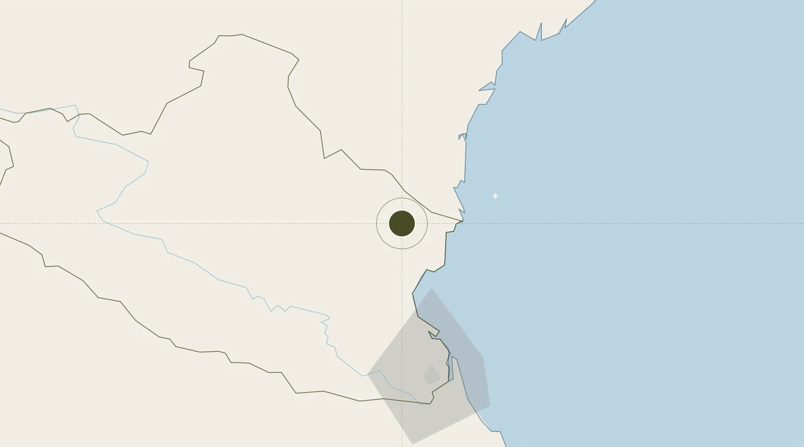
Diversified Zone · Vietnam

Hoàng Mai Mai Industrial Zone Active

19.2661°, 105.5737°
290 ha
Zone area
59.1 km
Nearest port
59.7 km
Nearest airport

Gateway access

Nearest neighbours — logibook spatial index (haversine) over the source coordinates

Zone profile

Zone type
Diversified Zone
Open Zone Map
Region
Nghệ An
Open Zone Map
Status
Active
Open Zone Map
Management
Public-Private Partnership
Open Zone Map
Operator
WHA Indutrial Management Services Vietnam Company Limited
Open Zone Map
Legal framework
Decree No.82/2018/ND-CP on Management of Industrial Parks and Economic Zones, Decree No 218/2013/ND-CP
Open Zone Map

Location

Location of ozm-5182
Natural Earth 10m (public domain) · Nghệ An · ozm-5182 · 19.27, 105.57GoogleOSMYandex

Nearby Logistics Neighbours

Ports
  1. 1Nghe Tinh59 km
  2. 2Hai Phong217 km
  3. 3Hon Gai244 km
  4. 4Cam Pha271 km
  5. 5Basuo320 km
Nearest neighbours — logibook spatial index (haversine) over the source coordinates
Airports
  1. 1Vinh Airport60 km
  2. 2Tho Xuan Airport72 km
  3. 3Gia Lam Air Base200 km
  4. 4Sam Neua Airport203 km
  5. 5Cat Bi International Airport210 km
Nearest neighbours — logibook spatial index (haversine) over the source coordinates
Cities
  1. 1Kim Dong23 km
  2. 2Nghi Son28 km
  3. 3Cua Lo52 km
  4. 4Culao54 km
  5. 5Vinh60 km
Nearest neighbours — logibook spatial index (haversine) over the source coordinates
Trade Zones
  1. 1Nghi Son Economic Zone20 km
  2. 2Nghi Son Coastal Economic Zone23 km
  3. 3Nghi Son Industrial Zone26 km
  4. 4Nam Cam Industrial Park50 km
  5. 5Wha Industrial Zone 1 - Nghe An51 km
Nearest neighbours — logibook spatial index (haversine) over the source coordinates
DatabookThe Record of Consolidated Knowledge
Vietnam beyond logistics?
Browse databook

All Sources

Trade ZonesOpen Zone Map
CC BY
Portsthe NGA World Port Index
Public domain (US gov)
AirportsOurAirports
Public domain
LocationsUN/LOCODE
UN/LOCODE — free
← Vietnam trade zones