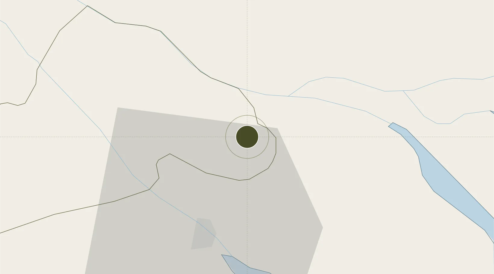
Diversified Zone · Vietnam

An Phú Industrial Zone Active

10.2157°, 105.8643°
74 ha
Zone area
111.5 km
Nearest port
22.5 km
Nearest airport

Gateway access

Nearest neighbours — logibook spatial index (haversine) over the source coordinates

Zone profile

Zone type
Diversified Zone
Open Zone Map
Region
Can Tho
Open Zone Map
Status
Active
Open Zone Map
Management
Public
Open Zone Map
Operator
Peoples Committee of Phu Yen Province
Open Zone Map
Legal framework
Decree No.82/2018/ND-CP on Management of Industrial Parks and Economic Zones, Decree No 218/2013/ND-CP
Open Zone Map

Location

Location of ozm-5025
Natural Earth 10m (public domain) · Can Tho · ozm-5025 · 10.22, 105.86GoogleOSMYandex

Nearby Logistics Neighbours

Ports
  1. 1Thanh Ho Chi Minh112 km
  2. 2Cat Lai117 km
  3. 3Thanh Hoa119 km
  4. 4Vung Tau132 km
  5. 5Phu My134 km
Nearest neighbours — logibook spatial index (haversine) over the source coordinates
Airports
  1. 1Can Tho International Airport23 km
  2. 2Rach Gia Airport85 km
  3. 3Tan Son Nhat International Airport109 km
  4. 4Cà Mau Airport138 km
  5. 5Long Thanh International Airport (Under Construction)143 km
Nearest neighbours — logibook spatial index (haversine) over the source coordinates
Cities
  1. 1Vinh Long11 km
  2. 2Binh Minh14 km
  3. 3Sa Déc14 km
  4. 4Tra Noc22 km
  5. 5Can Tho26 km
Nearest neighbours — logibook spatial index (haversine) over the source coordinates
Trade Zones
  1. 1Hòa Phú Industrial Zone9 km
  2. 2Sa Dec Industrial Zone17 km
  3. 3Tra Noc 1 Industrial Zone21 km
  4. 4Tra Noc 2 Industrial Zone22 km
  5. 5Định An Coastal Economic Zone57 km
Nearest neighbours — logibook spatial index (haversine) over the source coordinates
DatabookThe Record of Consolidated Knowledge
Vietnam beyond logistics?
Browse databook

All Sources

Trade ZonesOpen Zone Map
CC BY
Portsthe NGA World Port Index
Public domain (US gov)
AirportsOurAirports
Public domain
LocationsUN/LOCODE
UN/LOCODE — free
← Vietnam trade zones