Foreign Trade Zone · United States

FTZ No. 044 Morris County Active

40.8674°, -74.8584°
60.9 km
Nearest port
38.1 km
Nearest airport

Gateway access

Nearest neighbours — logibook spatial index (haversine) over the source coordinates

Zone profile

Zone type
Foreign Trade Zone
Open Zone Map
Region
New Jersey
Open Zone Map
Status
Active
Open Zone Map
Management
Public
Open Zone Map
Operator
State of New Jersey Department of State
Open Zone Map
Legal framework
Foreign-Trade Zones Act
Open Zone Map

Location

Location of ozm-4801
Natural Earth 10m (public domain) · New Jersey · ozm-4801 · 40.87, -74.86GoogleOSMYandex

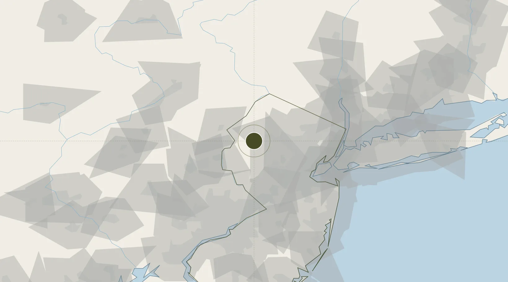
Nearby Logistics Neighbours

Ports
  1. 1Sayreville61 km
  2. 2Bayway61 km
  3. 3Elizabethport62 km
  4. 4Sewaren62 km
  5. 5Port Reading62 km
Nearest neighbours — logibook spatial index (haversine) over the source coordinates
Airports
  1. 1Morristown Municipal Airport38 km
  2. 2Lehigh Valley International Airport55 km
  3. 3Newark Liberty International Airport61 km
  4. 4Trenton Mercer Airport66 km
  5. 5Teterboro Airport67 km
Nearest neighbours — logibook spatial index (haversine) over the source coordinates
Cities
  1. 1Vienna2 km
  2. 2Johnsonburg9 km
  3. 3Port Murray10 km
  4. 4Clarksburg11 km
  5. 5Washington15 km
Nearest neighbours — logibook spatial index (haversine) over the source coordinates
Trade Zones
  1. 1FTZ No. 037 Orange County58 km
  2. 2FTZ No. 049 Newark Elizabeth61 km
  3. 3FTZ No. 200 Mercer County65 km
  4. 4FTZ No. 001 New York City74 km
  5. 5FTZ No. 272 Counties of Lehigh and Northampton78 km
Nearest neighbours — logibook spatial index (haversine) over the source coordinates
DatabookThe Record of Consolidated Knowledge
United States beyond logistics?
Browse databook

All Sources

Trade ZonesOpen Zone Map
CC BY
Portsthe NGA World Port Index
Public domain (US gov)
AirportsOurAirports
Public domain
LocationsUN/LOCODE
UN/LOCODE — free
← United States trade zones