Free Trade Zone · Saudi Arabia

Jubail Industrial City Active

26.9771°, 49.5549°
101,600 ha
Zone area
16.2 km
Nearest port
16.4 km
Nearest airport

Gateway access

Nearest neighbours — logibook spatial index (haversine) over the source coordinates

Zone profile

Zone type
Free Trade Zone
Open Zone Map
Region
Ash Sharqiyah
Open Zone Map
Status
Active
Open Zone Map
Management
Public
Open Zone Map
Operator
Royal Commision for Jubail and Yanbu
Open Zone Map
Legal framework
Royal Decree No. M/75 Dated Sept. 21, 1975.
Open Zone Map

Location

Location of ozm-4102
Natural Earth 10m (public domain) · Ash Sharqiyah · ozm-4102 · 26.98, 49.55GoogleOSMYandex

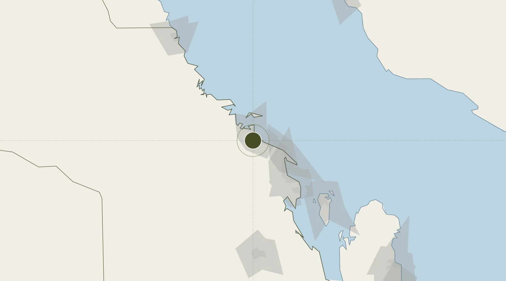
Nearby Logistics Neighbours

Ports
  1. 1Al Jubayl16 km
  2. 2Ju Aymah Oil Terminal48 km
  3. 3Ras Tannurah72 km
  4. 4Dammam83 km
  5. 5Al Manamah132 km
Nearest neighbours — logibook spatial index (haversine) over the source coordinates
Airports
  1. 1Jubail Airport16 km
  2. 2Ras Tanura Airport55 km
  3. 3King Fahd International Airport61 km
  4. 4King Abdulaziz Air Base99 km
  5. 5Ras Tanajib Airport126 km
Nearest neighbours — logibook spatial index (haversine) over the source coordinates
Cities
  1. 1Jubail6 km
  2. 2Al Jubayl Industrial City19 km
  3. 3Juaymah Terminal46 km
  4. 4Ras Tanura70 km
  5. 5Ras Al-Khair73 km
Nearest neighbours — logibook spatial index (haversine) over the source coordinates
Trade Zones
  1. 1Al-Ahsa Al-Aḥsāʾ Industrial City Salwa (Second)8 km
  2. 2Al-Ahsa Al-Aḥsāʾ Modon Oasis10 km
  3. 3Ras Al-Khair Industrial City68 km
  4. 4Dammam Industrial City (First)86 km
  5. 5Dammam Industrial City (Second)90 km
Nearest neighbours — logibook spatial index (haversine) over the source coordinates
DatabookThe Record of Consolidated Knowledge
Saudi Arabia beyond logistics?
Browse databook

All Sources

Trade ZonesOpen Zone Map
CC BY
Portsthe NGA World Port Index
Public domain (US gov)
AirportsOurAirports
Public domain
LocationsUN/LOCODE
UN/LOCODE — free
← Saudi Arabia trade zones